It was Ages ago we wrote here
i hope You excuse me for experimenting with other cameras than RICOH THETA
but this might be interesting for THETA users as well
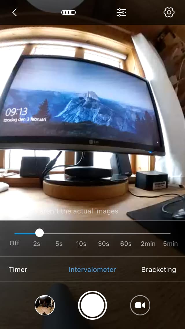
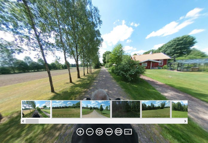
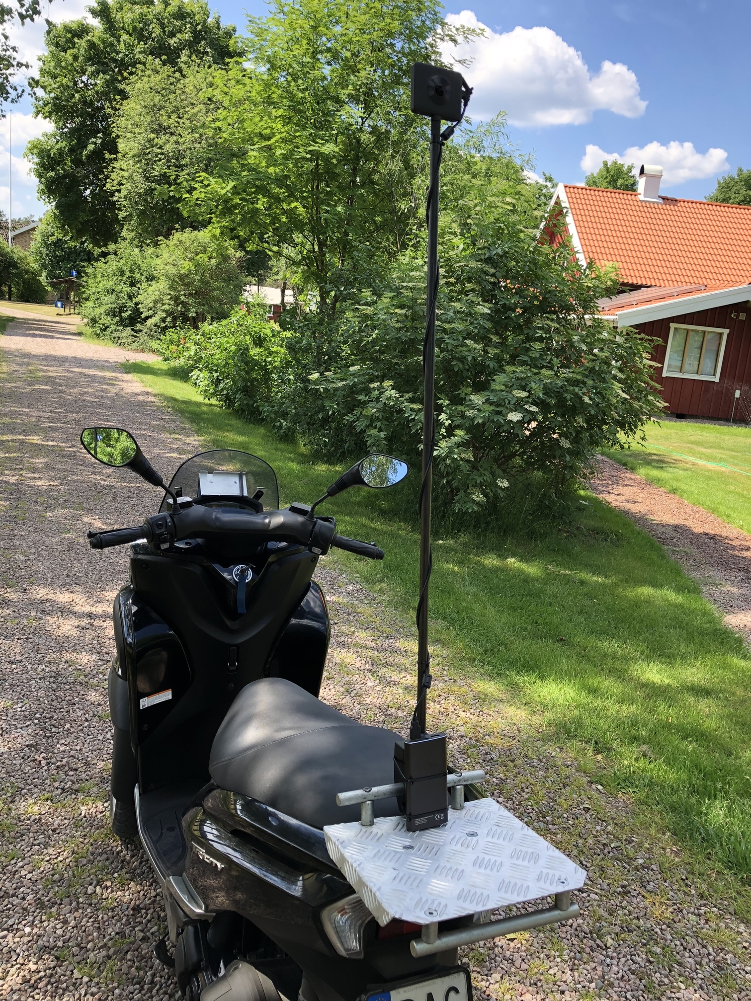
A Small test With Garmin VIRB image Time-Lapse in Pano2VR Beta 6 shot from the motorbike with 30 sec interval
it should be manual with a Bluetooth shooter in the finished tour.
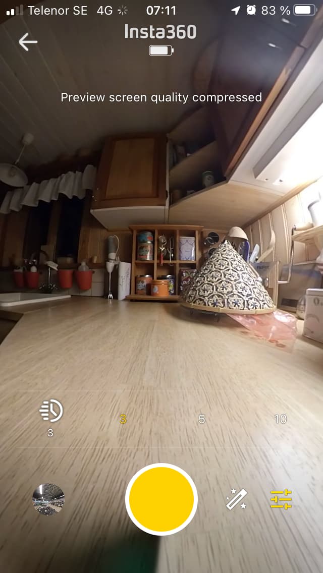
Another Google Maps Pano2VR beta 6 test with a Xiaomi Mijia MI SPHERE camera i Think the results are far better Photo Quality than the last one done with The Garmin VIRB 360
The MI SPHERE do not have a inbuilt Compass so the North must be sett manually in Pano2VR
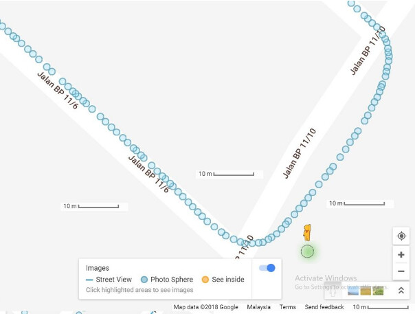
The GPS info are picked from the iPhone sitting in front of the motorbike and become quite exact
Do the current cameras you use have video to virtual tour capability with frame extraction? Or, are you using still images for all the virtual tours in 2022?
Is there a 360 camera on the market that can take low fps video (around 2 fps for walking, or 5fps, 10fps for driving) at approximately 32megapixel 8000x4000 to get the same results in blue line video shooting as the examples you provided?
From your motorcycle, what is the best framerate for the video?
When shooting from a mowing vehicle
you need high frame rate i normally shoot 50fps
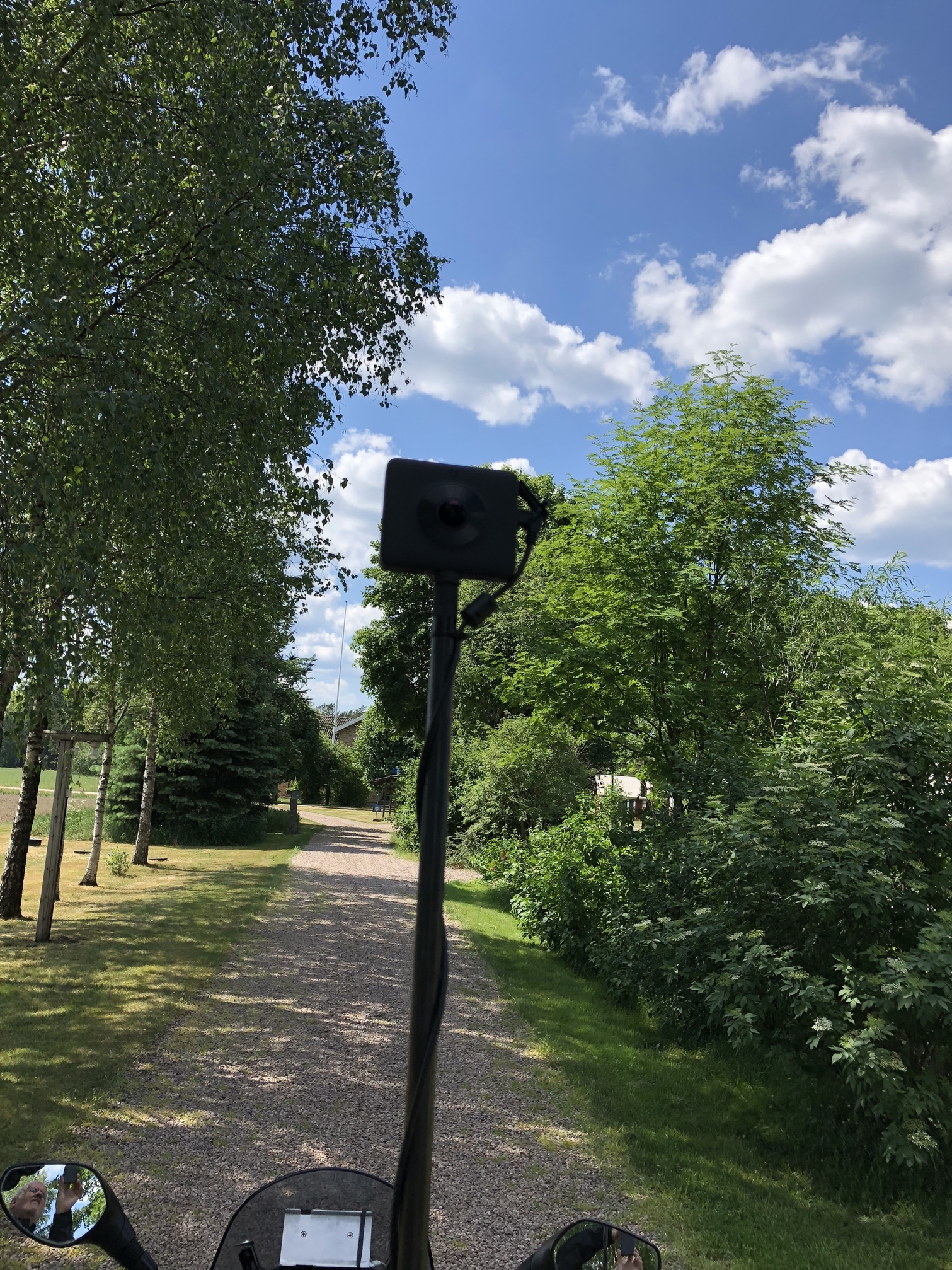
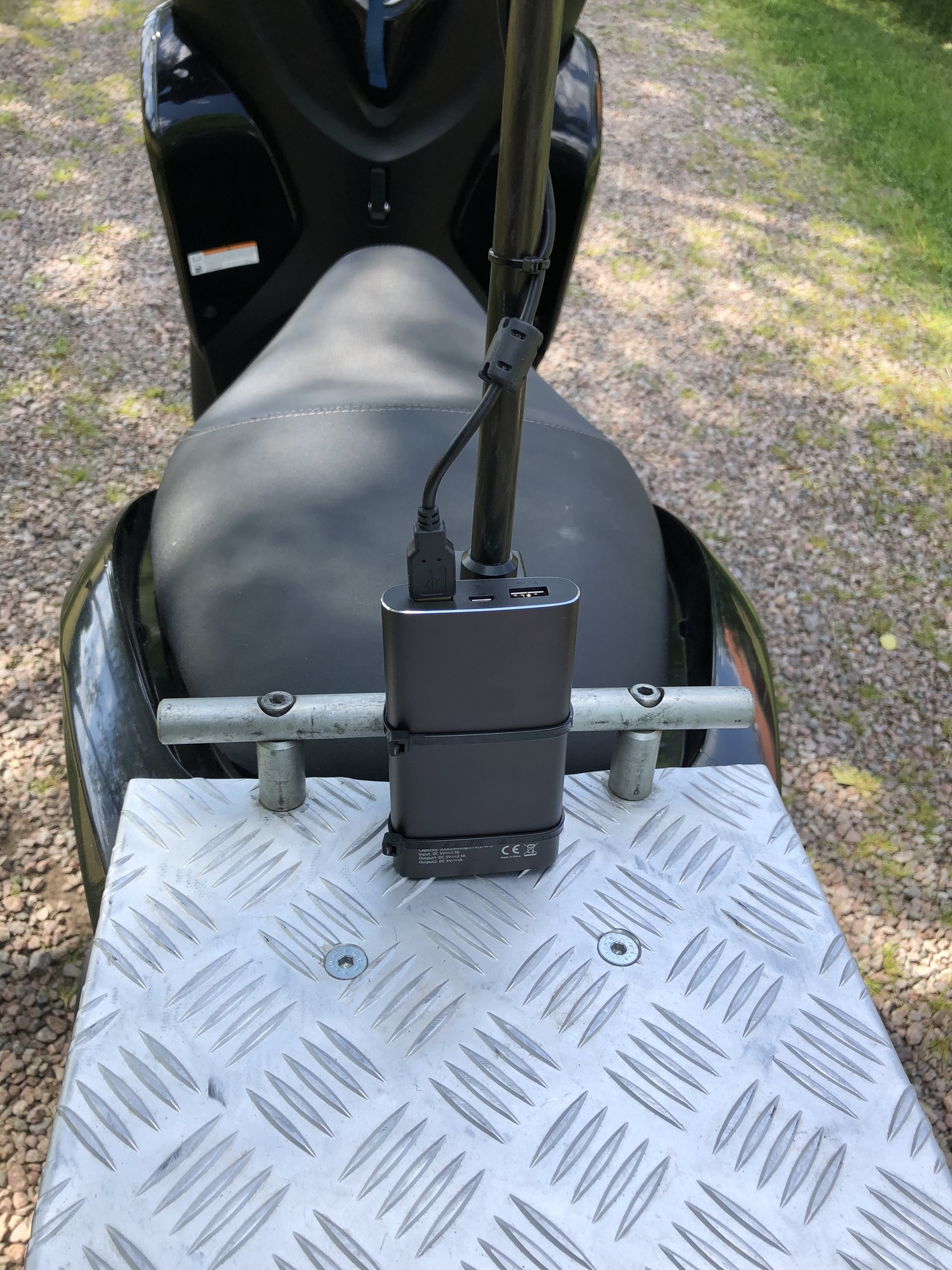
check third Panorama to see the camera mount and the video projector in the last Panorama on this link
for lower frame-rate walking i think you have to use intervall or timelapse
3 sec are the lowest on most cameras,
but on a good editing software you can go to lower frame-rate from a 30p video if you want
I am GSV trusted @level 8 and allowed to shoot blue line on google maps but i do not have a camera that are able to do this
sadly the THETA X are rather expensive here even more expensive than the Z1
thanks for sharing that link to the article about making blue lines with the THETA V in 2018.
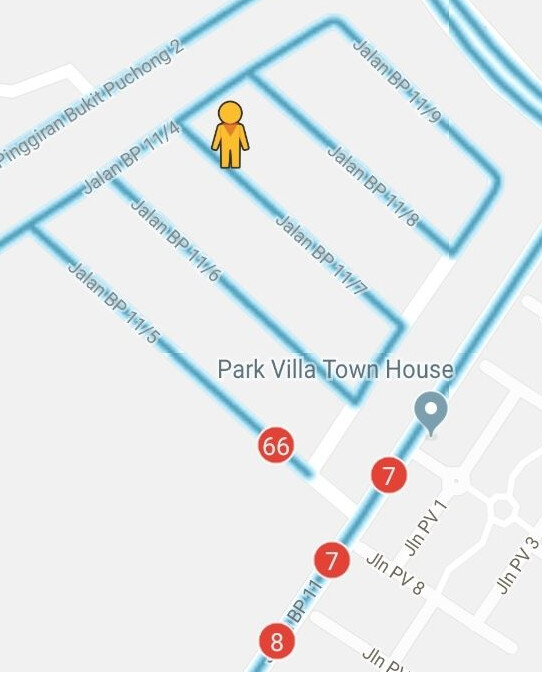
I was driving at about 20-30km per hour. It’s a housing neighborhood. From what I can see, I am getting about 1.5 meters per panorama. Which is very high density and tight capture, which is good.
Navigation and connection is quite accurate (picture below)
Yes thees Russian guys are rather skillful filming 360 from the sky i also have a small drone and it is fantastic to shoot 360 high resolution photos with it


 with the new THETA X i think i will soon be Back