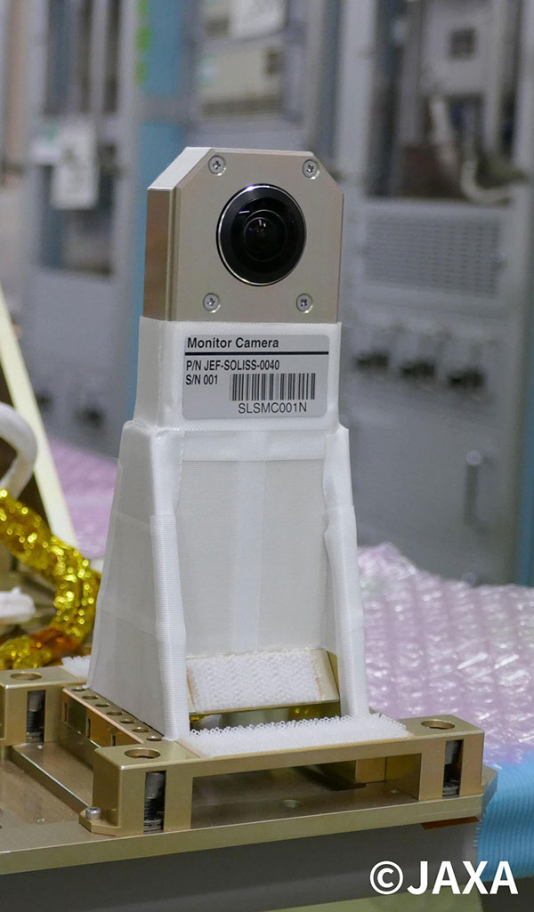
Through a partnership with JAXA, Japan’s equivalent of NASA, a newly-developed Ricoh Theta camera based on the company’s consumer 360-degree camera line will be mounted on a JAXA / Sony-developed module called SOLISS, the Small Optical Link for International Space Station.
are you aware that all photos taken with a Theta V are allocated a near enough GPS coordinate to about 40m accuracy?
its a problem I have been trying to get some awareness of for some years. no one seems to care.
Instead of embedding lat long like this DD.DDDDDDD with 7 decimal places, all photos are embedded with only a few decimal places, meaning they plot on a grid of 40 by 40 metres.