Did you use an iPhone because there were no Android apps to do this from the Android tablet on your desk?
Tablet had no charge and I was charging it.
got it. I was just wondering if there was an Android app available.
I’m curious as to the accuracy of the image when it appears on Google Maps.
One of the photos was published using Google Maps via an iPhone. Another was posted using plord12/360tools. They both seem to be in the right location with their own unique photo spheres.
Unfortunately I didn’t document which photo was published with which tool but luckily I have two more photos that I haven’t published which I’ll note which tool is used this time.
On iPhone I remember being able to just type in “Palo Alto, CA” and add it as the location and on android this time today I had to select a nearby location. So in the new test I’ll show the results of both tools one using Android Google maps to publish and another using plord12/360tools .
2 Likes
First Photo was published on an Android Tablet where I was given no option to select a general location and had to select the closest location. The location for this one is incorrect.
Second Photo was published with plord12/360tools with no issues. Location is correct and uploaded it using a windows laptop.
The ghosting is due to using HDR while moving. For outside shots holding the monopod in your hand, you should disable HDR.
Is the problem only occurring on Android with the Google Maps app?
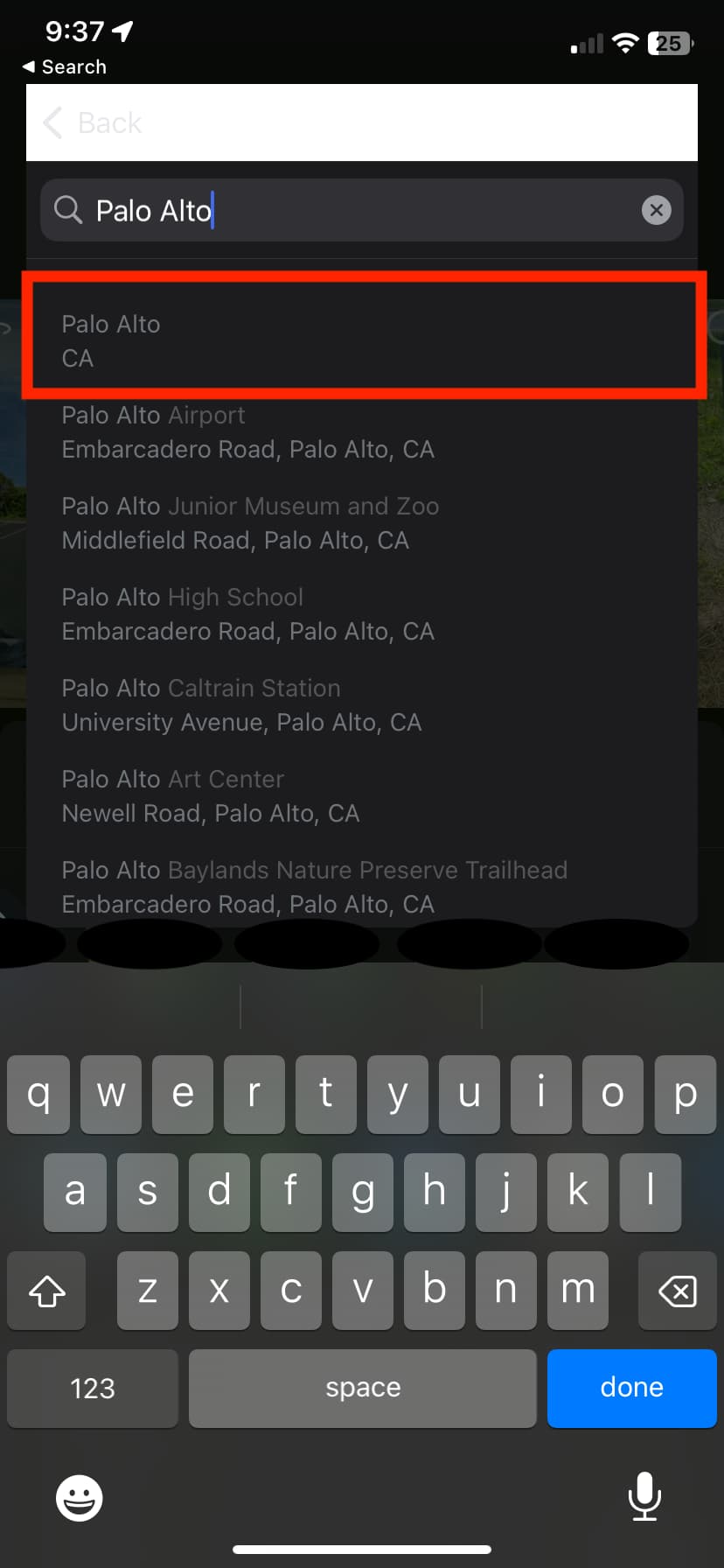
In an iPhone I am able to select “Palo Alto, CA” as my option as shown in the red outline.
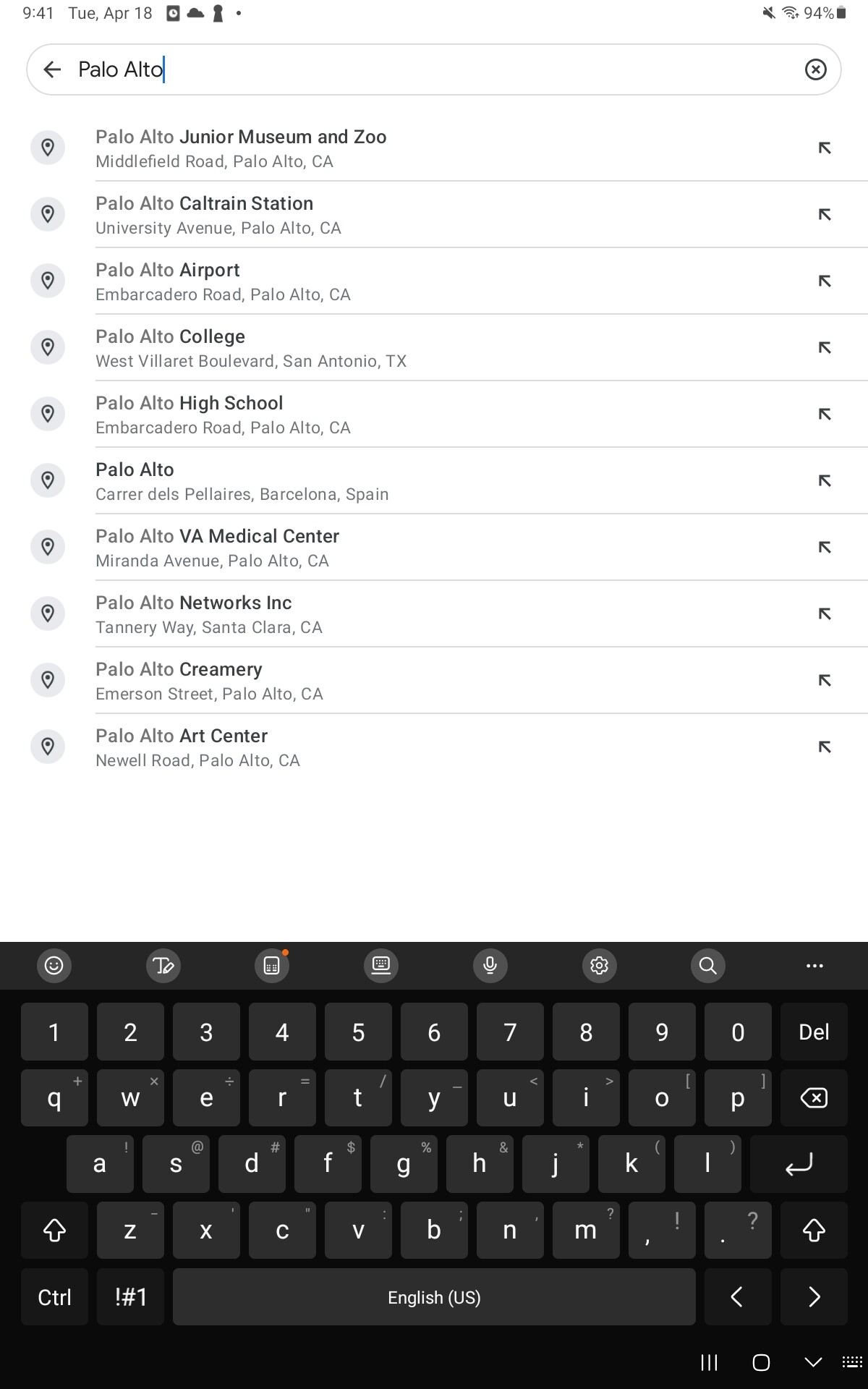
In an android tablet I am not given the option to select a more general location. I have to choose a location that would be nearby.
you should work with @jcasman to share this problem and the solution by peter on places like Facebook Groups.
As Google is involved in the development of both Android and maps, I would expect the Android maps app to work well. It’s surprising that there is no way to specify the location based on the GPS coordinates.
One tool which works well for geolocating 360 images is Kuula (https://kuula.co/). It is an online service which is dedicated to building virtual tours and sharing those tours with others. The service has a feature that allows you to view images with map location information (EXIF) in a Google Map. What I don’t like much is that when you zoom in a lot it transitions into a bird’s eye view…but oh well, not a big deal. You can try out Kuula for free using their basic plan, or you can pay $20/month for their pro plan. I pay the pro and pay it on an annual basis and it works great. One important thing…in order for Kuula to recognize images with location data, you need to go into the Preferences, under EXIF Metadata, select Make GPS location public. Give Kuula a try and see if that meets your expectations.
2 Likes
Kuula uploads 360 images on Google Maps or not?