Options to display 360 images on a public map

I’ve just picked up an SC2 and am looking for options to display on a map. Main use will be leisure ( walking, festivals etc ) rather than business, so maybe a URL for an event ( eg “Our coastal walk” ).

Google maps Photosphere was the first thought … but I’m finding the locations arn’t right ( reported at Photosphere blue dot on google maps does not reflect the actual location of my 360 picture - Google Maps Community ) making it useless for sharing a photo in the middle of a field.

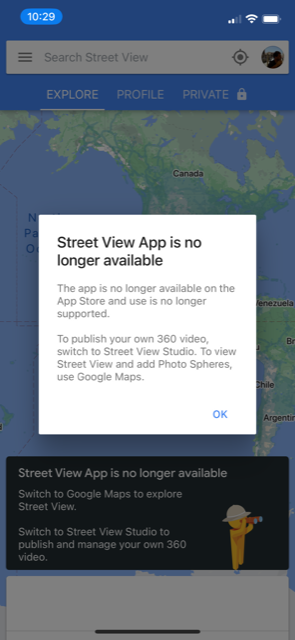
I saw that the Google Street View app is going away and replaced with Google Street View Studio … however this doesn’t support individual images only mp4’s. I have managed to create such an mp4 from a series of 360 images but Google is still processing the images after a couple of days.

In the past I’ve used OpenStreetMaps umap ( eg Glastonbury - uMap ) - I have figured out how to display 360 images in an iframe … so this is one option.

Facebooks Mapillary ( https://www.mapillary.com ) is another option … but again its taking days to process image.

The THETA android app does have a “theta360” tab but that just shows me “404 File Not Found” so I can’t tell what that might do for me.

Any other option available ?

Thanks.

You can test Pano2VR for functionality. It will be watermarked on the free trial version.

You can also test UL2GSV for free with not limitations on functionality.

https://groups.google.com/g/ul2gsv

It may make it easier to upload to Google Streetview.

Thanks.

I did try Pano2VR and attempted an upload to Google Maps … it seemed to be working ( oauth worked, file started to upload etc ) but then failed -

I assumed thats related to the Street View app going away … so I gave up.

Any other websites to try that show 360 photos on a map ?

Thanks.

there could be other systems, but the only one I have experience with is openstreetmap.

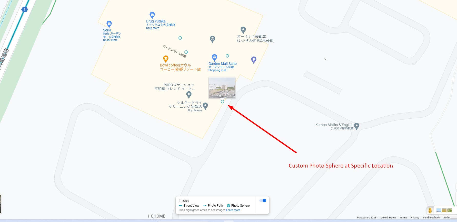
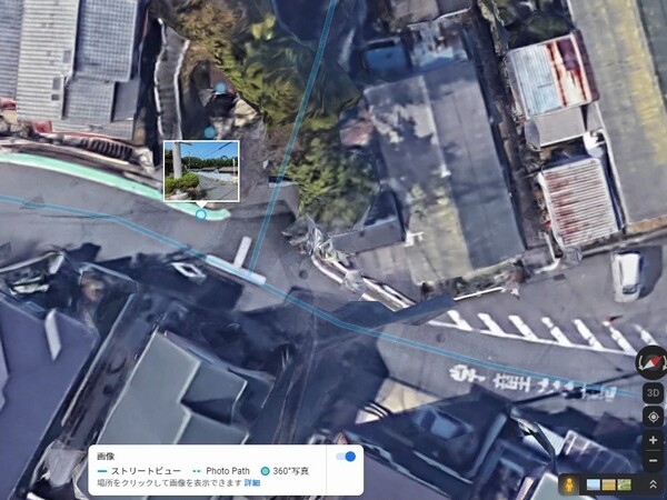
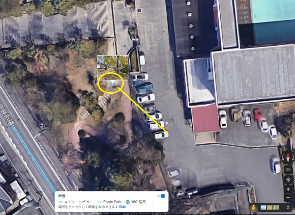
Had some follow-ups to the above post … as supected the PhotoSphere blue dots always snaps to the place name. As a poster said, “… the blue dot feature is useless.”.

I guess I’ll invest my time in OpenStreetMaps umap ( https://umap.openstreetmap.fr ).

Thanks.

For the Google Maps PhotoSphere option I found a description on how to publish without the Google StreetView or Google maps apps. See Make your first API calls  |  Street View Publish API  |  Google Developers. Boils down to authenticating and running some curl commands.

I sure hope Google makes this easier soon.

1 Like

@erikrod1 put together a guide to using Tasker. It may be possible for him to modify the guide to upload an image to Google Streetview. I’ll ask him.

https://theta360developers.github.io/tasker-guide/

It can’t be helped. Google just rejected the watermaked image.

You can upload any 360 photos on Google Maps from “Add a photo” button.
It’ll be display in Street view & 360 tab without extra cost.

Hope you enjoy.
Toyo

1 Like

Not really … the image location snaps to the location of the “place” and the actual location of the image is ignored … ie the blue dot is in the wrong location. Confirmed at Photosphere blue dot on google maps does not reflect the actual location of my 360 picture - Google Maps Community

Not really?

PE knows how to use the right tool?

Can do that with Pano2VR.
But it’s not free.

Toyo

2 Likes

Banged my head against this for months. Blue lines via mp4’s DO work with the app. Adding single 360’s via Google maps app doesn’t. Free solution: emulate an older version of street view:

https://apkpure.com/google-street-view/com.google.android.street/versions

I’ve using version Google Street View 2.0.0.268460236 (40449) Run an Android emulator like Bluestacks. Works perfectly (for now). It’s glorious.

2 Likes

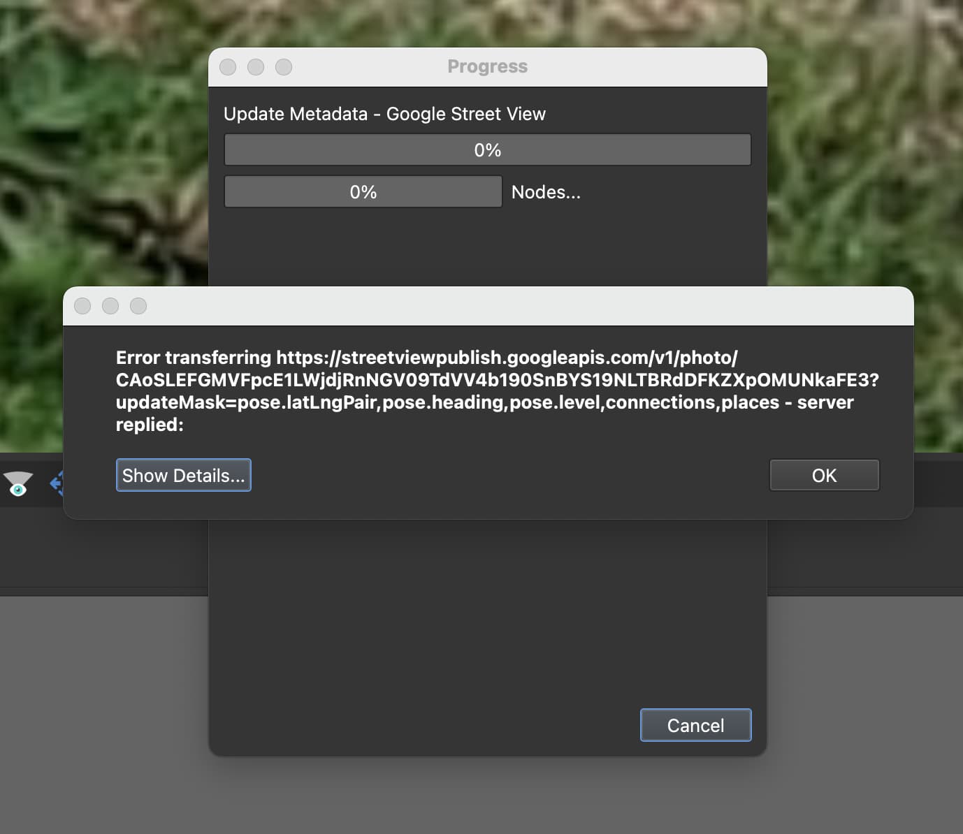
Presumably this example was posted to google maps with either the street view app ( no-longer works ) or, as you suggest, the expensive Pano2VR ( which throws an error for me ).

Really good idea, thanks.

To summarise my investigations -

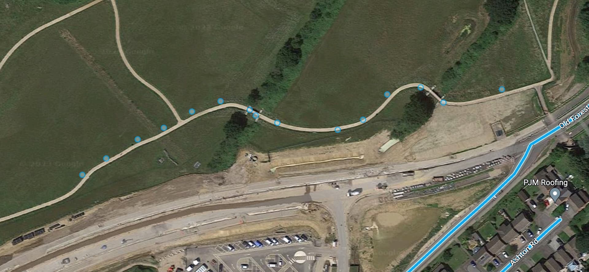
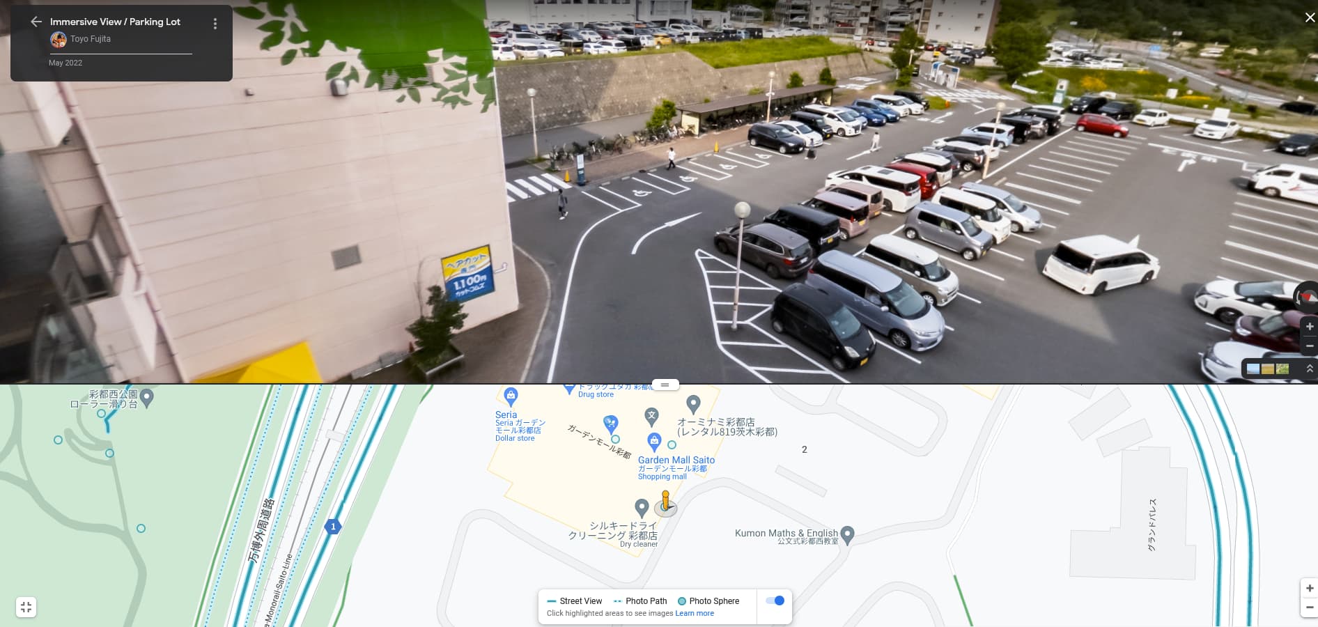
  • Upload 360 picture with Google Maps app or Google Maps web the location (blue dot) is shown as the named place, not the location of the picture
  • Current Google Street View app does work (for me) and anyway is being withdrawn … work-around is to run an older version under emulation
  • Google My Maps doesn’t support displaying of 360 pictures
  • Testing with Pano2VR started to work ( picture was uploaded to correct place ) but then Pano2VR throws an error
  • It’s possible to use the Google API to upload a 360 picture with the location (blue dot) is the actual location of the picture
  • It should be possible to convert a set of 360 jpg’s to an mp4 and upload via Google Street View Studio … but I found it never gets past “processing” stage ( running more than a week )
  • Umap works … ie has enough hooks to display 360 pictures. However, pictures do need to be stored on your own server
  • Finally, I found the android THETA app crashes whilst attempting to parse dates … reported to Ricoh but I’m not hopeful

I’m sure glad I didn’t invest a lot in the camera.

I might end up writing a stand-alone cli tool to upload 360 pictures to google maps ( via the API ) and perhaps generate umap configurations. Or maybe hosting my own umap instance.

Can you provide more information on when the THETA app crashes with the SC2?

  • phone model
  • OS version on phone
  • SC2 firmware version
  • mobile app version

when does the crash occur? For example, does it crash when you attempt to list the images on the mobile app?

5 posts were split to a new topic: RICOH Official Mobile App Crashing with SC2 and Android 13

I can confirm that @Juantonto photo sphere is in the correct location with your custom name that you have for it.

Will test out your method and see if it works for me.

1 Like

Hi, @erikrod1
Thank you for your confirmation. Here is another story.

ss_2023-04-01 124441

Published the virtual tour on Maps for the small and old shrine.
Camera: Theta Z1 and HDR(RAW)

Hope you enjoy, again.
Toyo

1 Like

I see this was published last year … I bet if it was published today ( with google maps or google street view ) you would get different results.

Nothing changed.

ss_2023-04-01 171442

The image above was captured with SONY ZV-E10 + Tokina SZ 8mm FISH-EYE and published it from Pano2VR Pro ver.6.

Today published another 2 linked images captured in Kyoto. Those will come alive soon.

However, those are not the sample of RICOH camera, too.
Toyo

Ah, thanks. I would expect Pano2VR to get it right ( although I did see an error myself when I tried the trial version once, although the picture itself was uploaded correctly ).

Thanks for the detail.

1 Like

Google Street View doesn’t allow me to upload photos anymore.

Street View Studio only Takes in Videos not Single Photos.

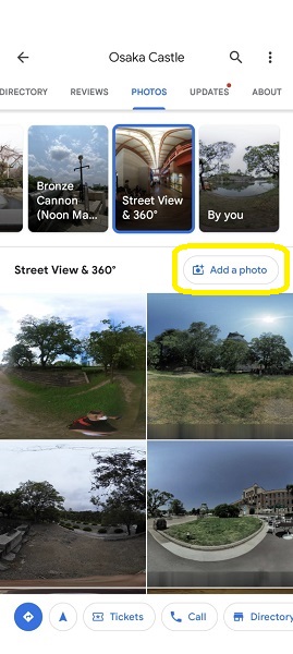
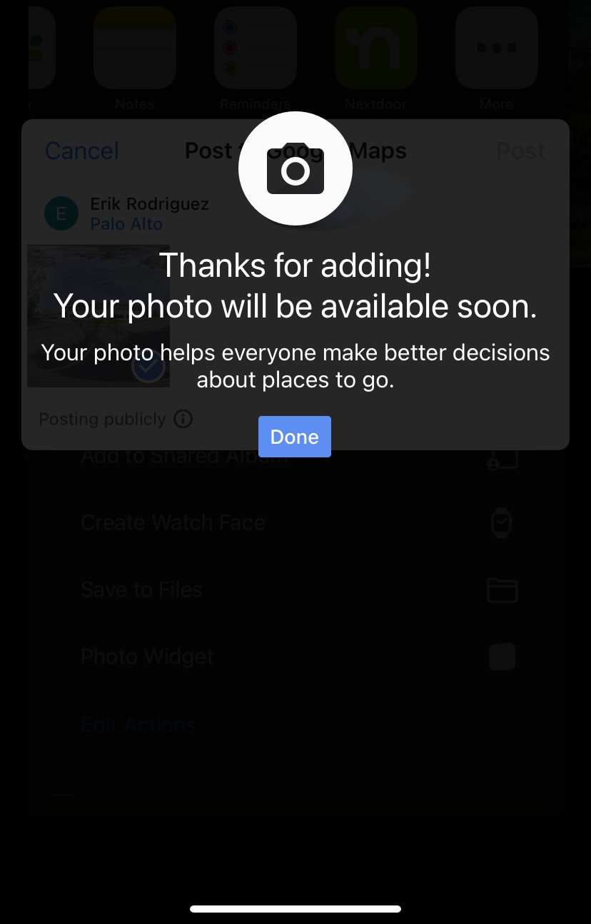
Uploaded 360 Photo to Google Maps via iPhone waiting for it to be published and see results of the location/photo-sphere. Wasn’t straightforward for me to do.

Also before I uploaded, the app asked me to “Choose a location” and I set it as Palo Alto, CA

1 Like