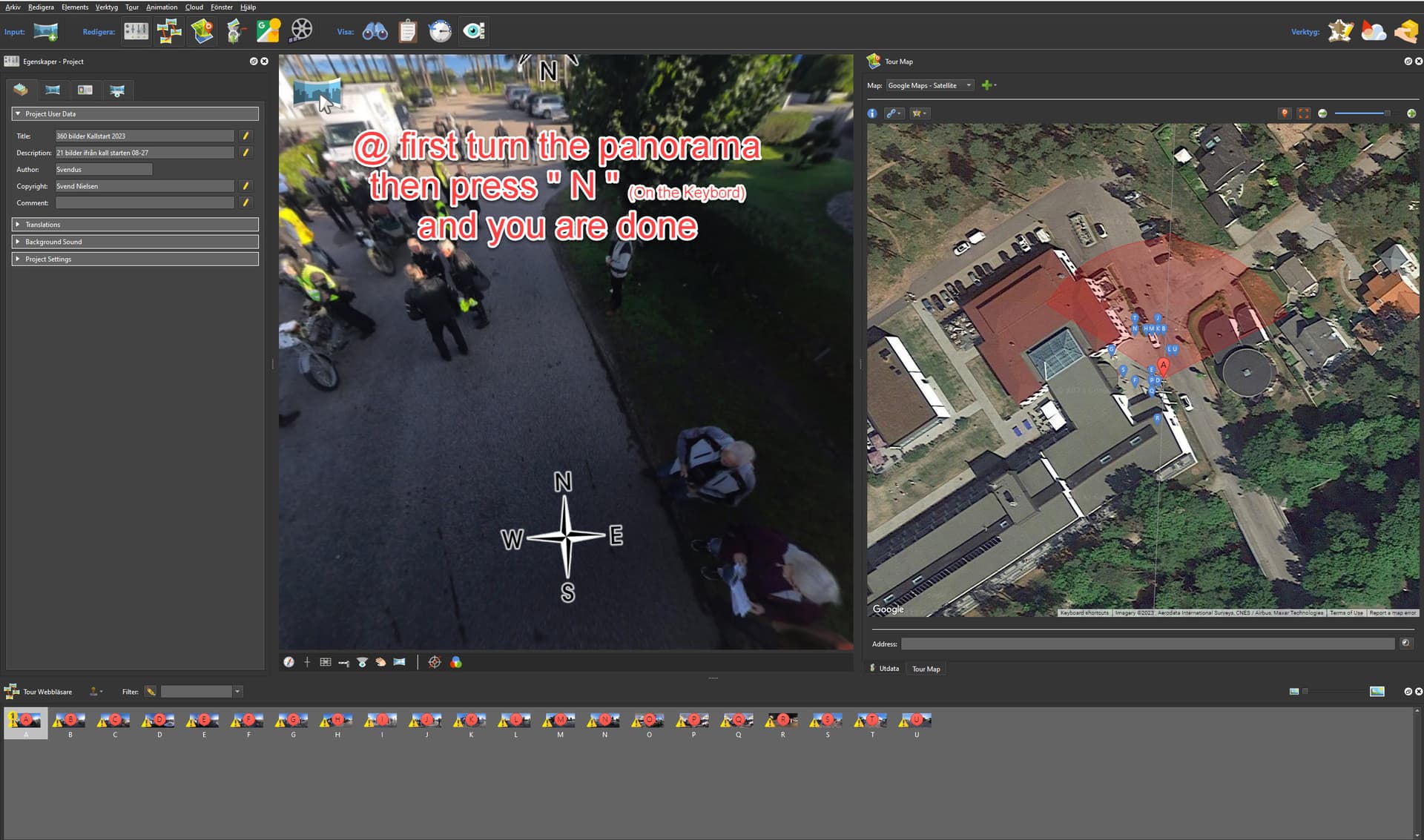
I recently had problems extracting GPSImgDirection from THETA X image metadata. This information is used for auto-placement orientation of images on maps.
After many attempts, a friend told me that I needed to reset the internal X compass. On my unit, the compass had become disoriented due to exposure to a magnetic field. These fields are common around office equipment.
I used the motion in this video.

The figure 8 motion was the same for the Z1 and the X in my experience.
The X did not show an error on the LCD. It was a bit tricky for me to figure out the compass needed to be reset.
I used THETA X firmware 2.21.0

In a previous test, I had identified that the THETA X had a compass:

exiftool
To extract the metadata, you can use exiftool.
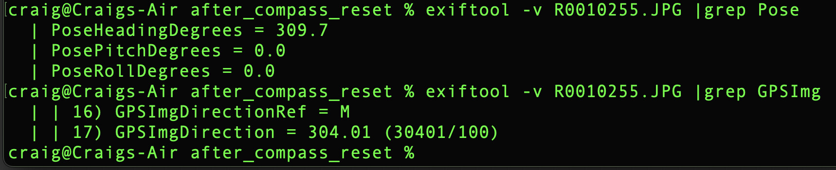
exiftool -v R0010255.JPG |grep GPS
| 12) GPSInfo (SubDirectory) -->
| + [GPS directory with 21 entries]
| | 0) GPSVersionID = 2 3 0 0
| | 1) GPSLatitudeRef = N
...
...
| | 5) GPSAltitudeRef = 0
| | 6) GPSAltitude = 214.1 (21410/100)
| | 7) GPSTimeStamp = 21 27 0 (21/1 27/1 0/1)
| | 8) GPSSatellites =
| | 9) GPSStatus = A
| | 10) GPSMeasureMode = 5
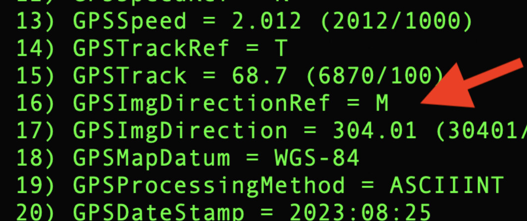
| | 11) GPSDOP = 11.19 (1119/100)
| | 12) GPSSpeedRef = K
| | 13) GPSSpeed = 2.012 (2012/1000)
| | 14) GPSTrackRef = T
| | 15) GPSTrack = 68.7 (6870/100)
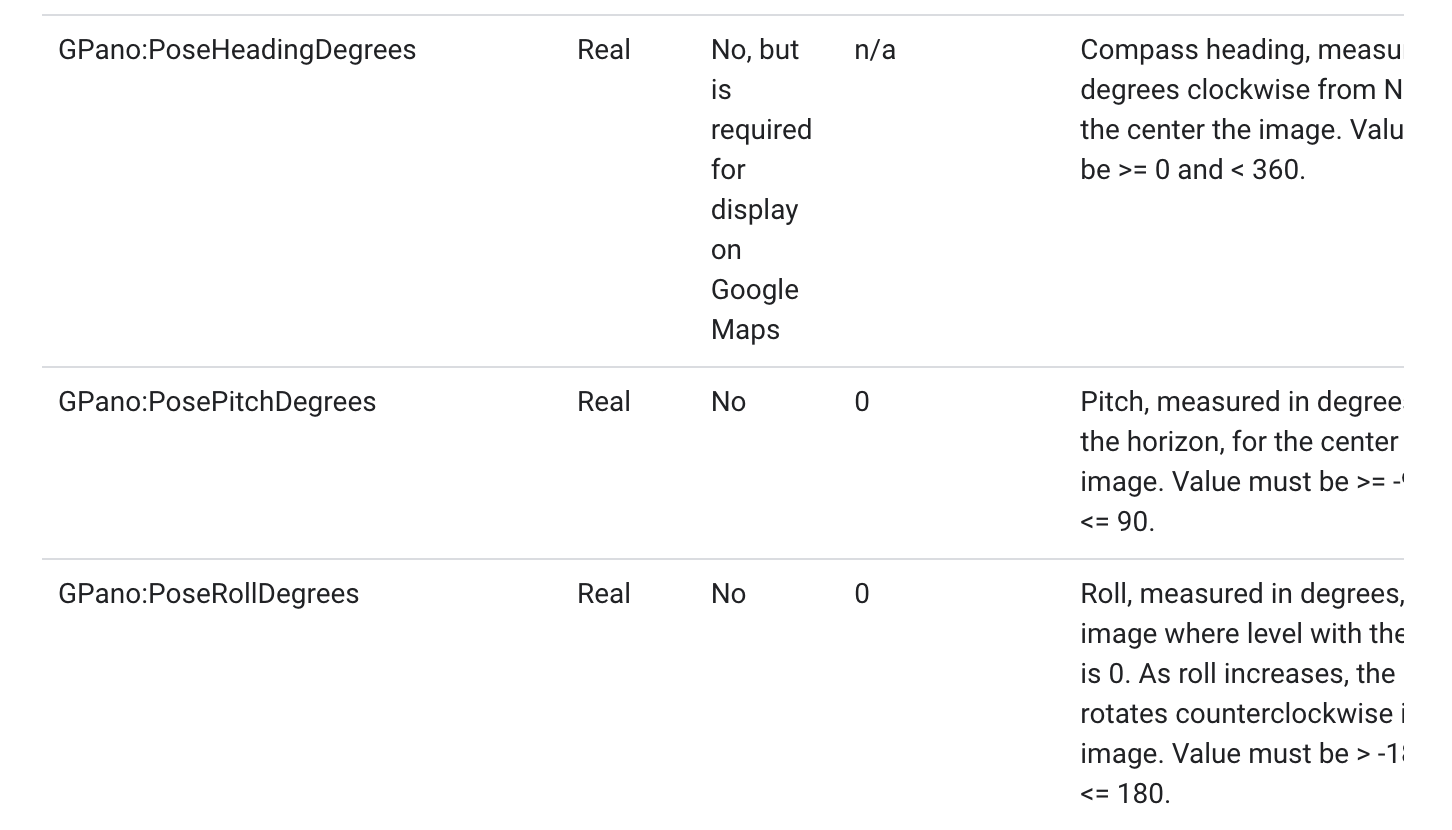
| | 16) GPSImgDirectionRef = M
| | 17) GPSImgDirection = 304.01 (30401/100)
| | 18) GPSMapDatum = WGS-84
| | 19) GPSProcessingMethod = ASCIIINT
| | 20) GPSDateStamp = 2023:08:25
summary
If you are having problem with image placement on maps, you may want to verify that GPSImgDirection is available in the image metadata.