Now it becomes easy and precise to work as local Guide on Google Maps
leaving the mobile Street View app far behind
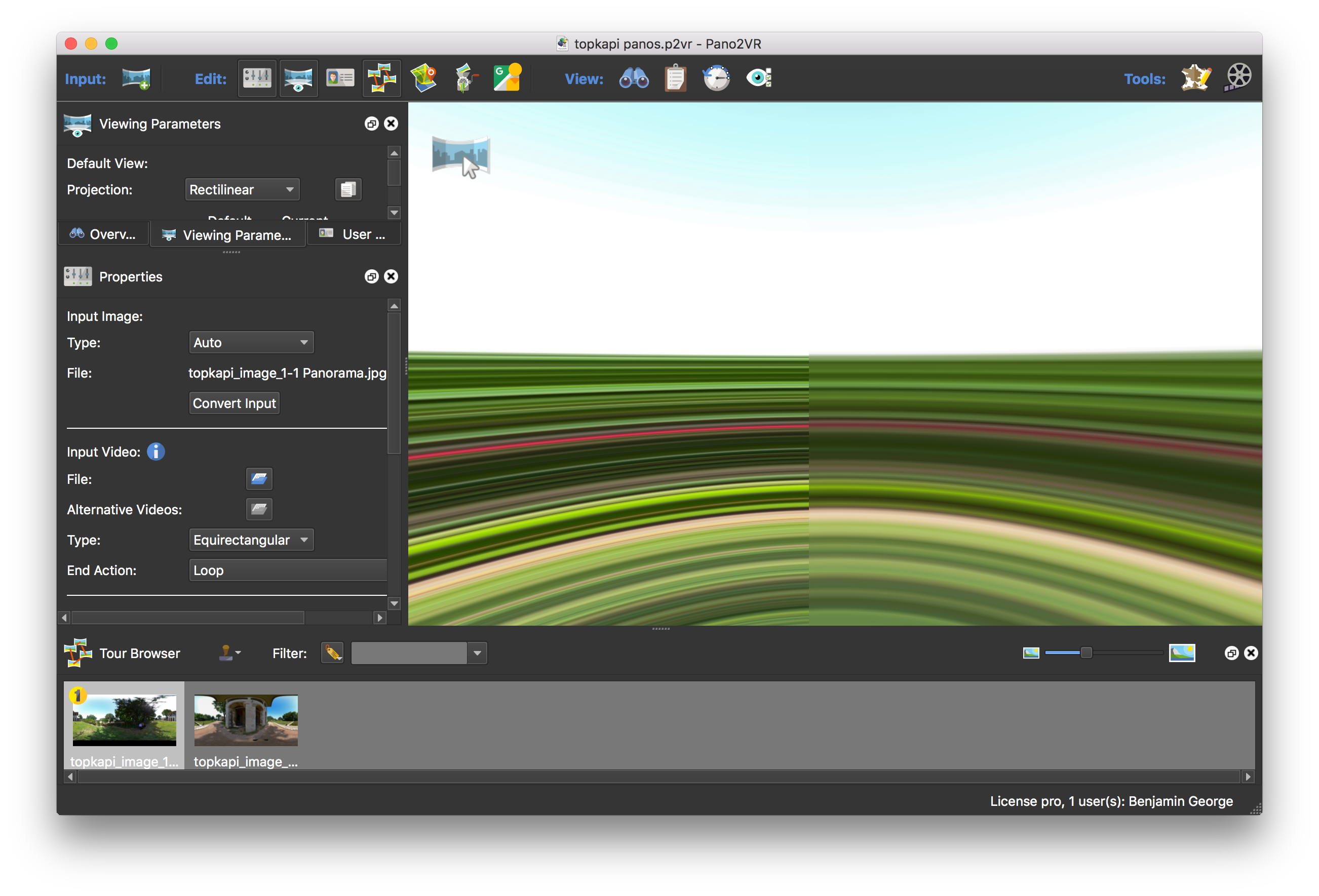
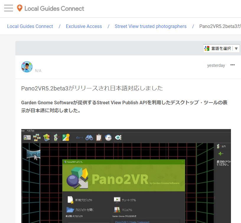
Pano2VR 5.2 beta — What’s New
The big news is the Street View Export,
Pano2VR 5.2 beta features the new Google Street View Export., it have integrated the export as part of the software.
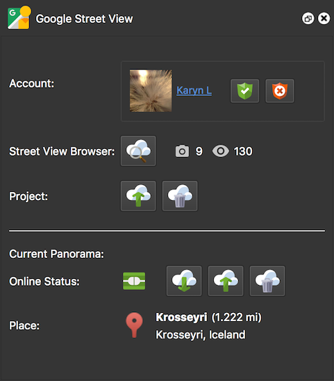
Google Street View Panel
Open the Street View Panel from the Toolbar, connect your Google account and upload your project directly to Street View.
To add connections just add hotspots to link the panoramas.
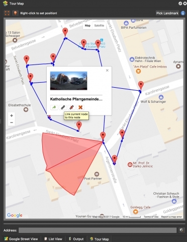
Improved Map View
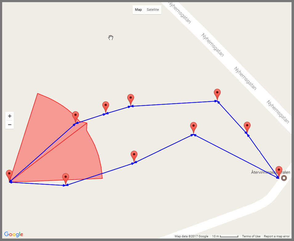
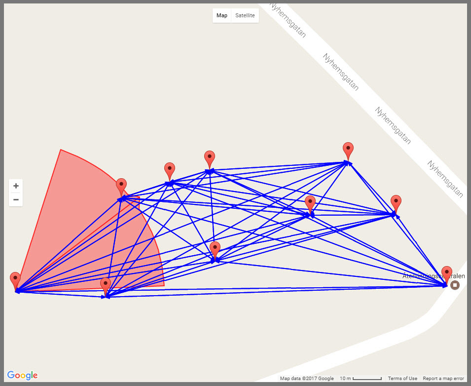
You can now see linked nodes and you can also create links (hotspots) directly in the map.
Map in Pano2VR 5.2
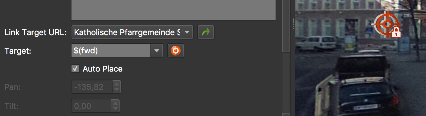
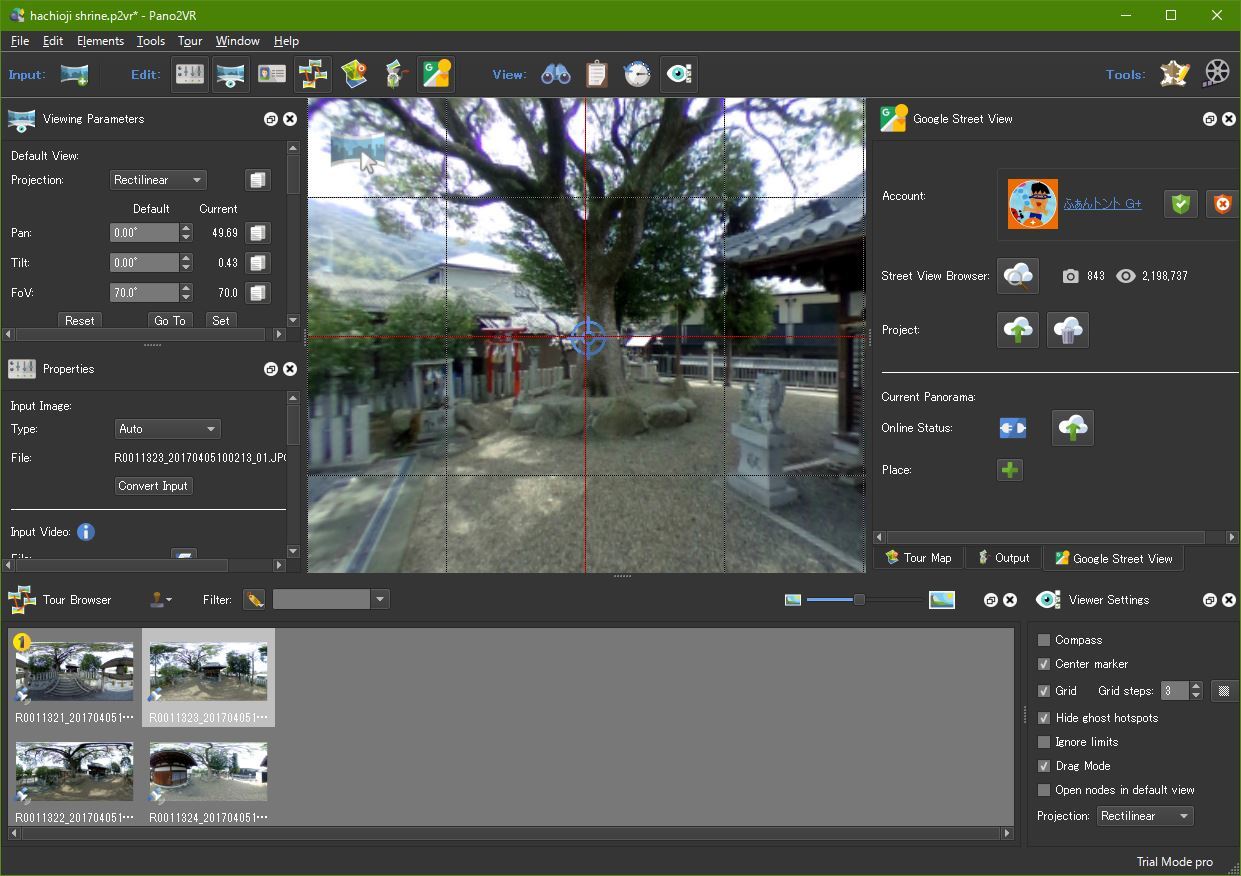
Auto Place Hotspots
In the Hotspot Properties panel, you will see a new option called, Auto Place. When this is selected, the hotspot is automatically positioned in the correct location of the linked panorama
Auto Place
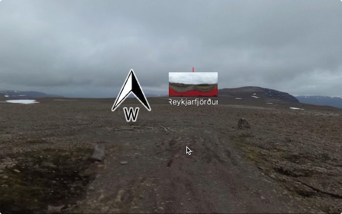
Set North
You can now set North by pressing N and dragging the panorama to achieve the correct
heading.
If you have connected hotspots in Pano2VR Pro, you will see a thumbnail of that panorama to help the guide placement.
We shall try to make a small Guide how you can
Add a New Place that not yet are on Google maps and Name and Place it
But first one has to become a Local Guide
Here below are a link hope You get the English Version
The new Google API now allows Third party Programmers
to create small miracles that helps New Trusted Photographers and Local Guides to Edit Metadata, GPS and upload Photosphere from Mac and PC desktop
Edit:
New Mini and Max Size on Google Maps are now 14 - 100 Megapixel
At least 14 megapixels (5,300 by 2,650 pixels) and at most 100 megapixels (14000 by 7000 pixels) with a 2:1 aspect ratio. In jpeg format.
100 MP Examble https://goo.gl/maps/QJR51UrDhUM2
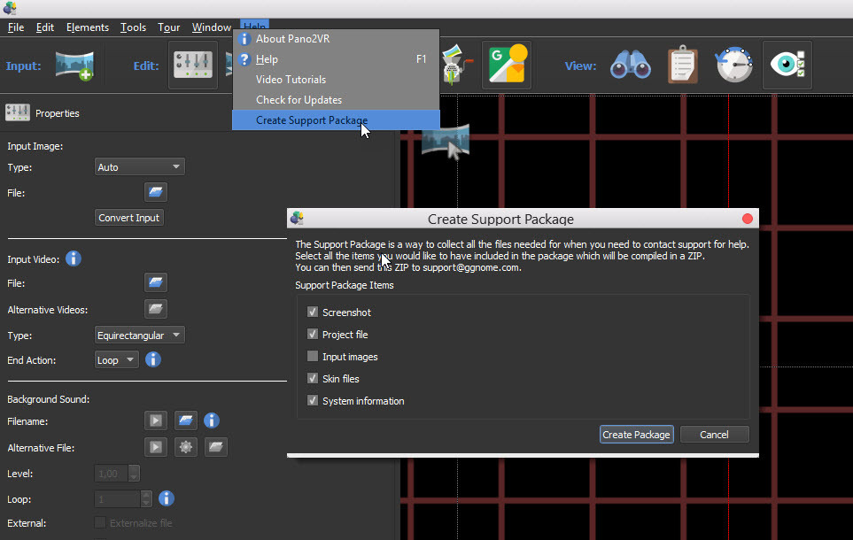
The Support Package is a way to collect all the filés needed for when you need to contact support for help.
Select all the items you would like to have induded in the package which wfl be compiled in a ZIP.
You can then send this ZIP to support@ggnome.com.
Things happen uploading to Street View
here on this example the place did exists on maps
so we uploaded 10 images to this place,the location shows up directly in
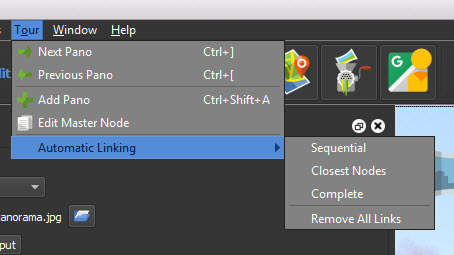
our Google index using Automatic_Linking / Sequential
all links are functioning
but when you search the images do not show up in that location :?:
All right we were waiting a couple of days and the images appeared on the search in Google Maps
We had to edit the links in the iOS Street View app to be able to edit the links to the node where i parked my Tricity motorbike
now it is running
the Google API are actually not stable yet
but i think it will be updated soon.
No @Juantonto the HTML5, Flash and Quick Time VR Output are for creating Panorama only.
Click on the map icon to set the GPS positions, Level the Panoramas pressing L
Then make sure the North are correct pressing N and turn each panorama until its OK,
then You can use auto linking if You want,
or make the linking manual by dragging each node in the open Window to the Next
Save the project.
When logged in to your account upload the project it is possible to change the linking
and all the metadata later if necessary
the images are recognized and the Meta data replaced
if any change are done graphic in a image it has to be deleted first and uploaded again
PS. its an advanced program and the skin editor are awesome have fun.
Do you ever have problems with the camera orientation in the metadata from the THETA images messing up the navigation of Google Streetview? I recently exchanged messages with someone that was having problems with image orientation. I suspect it’s because he edited the images and didn’t zero out the pitch and roll.
Just wondering what your experience with streetview orientation is like.
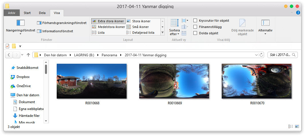
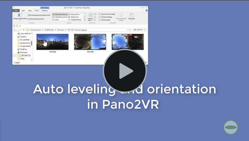
Pano2VR automatically levels and turn the image to right Orientation here are a small screen-cast from uploading 3 THETA S example images this morning
Regards Svendus
Hi, Svendus.
I made the post about new beta version on LocalGuides Connect. I am struggling to master this Big tool.But the Japanese translation may help me.Thanks.