Theta Z1 GPS track in VIDEO files

Hi, I’m trying to find a way to extract GPS track from videos taken with Theta Z1.
I’m taking videos using theta apps with GPS access. It seems like there is GPS metadata in the mp4 files, but can’t find a way to extract full track.
Does somebody know if there is only STATIC gps data (for first frame or something) or DYNAMIC data (gps tag every second or something similar) is available as well?

The technique described below does not work with the RICOH THETA as the sample files used are not from a RICOH THETA camera.
360-camera-metadata/ricoh at master · trek-view/360-camera-metadata · GitHub

However, it gives you an idea that you can manually use exiftool to inspect the metadata. If you find the GPS track, please post the actual area of the GPS data.

If this is for potentially high-volume camera deployment, please contact @jcasman.

3 Likes

@craig, thank you for pointing out the github resource, I didn’t come across this paper in my research.
The paper mentioned that Theta Z1 uses camm specification from google.
image
Which I can’t find in the video files produced by Theta Z1.
image
What I found is same GPS position, recorded in EXIF, XMP and quicktime formats.

I’m glad you mentioned potential camera deployment, there is a large community of outdoor google street view photographers who like the Theta Z1 very much but don’t use it because it doesn’t record the gps track(or there is no way of extracting it yet). Which adds complexity to the workflow.
Potentially, if this problem will be resolved, a high volume of cameras will be on the streets and hikes recording…

I’m assuming, since it’s an android device, it should have native ability to support the camm track, and maybe this is something that isn’t turned on.

P.S. I use constant GPS setting in Theta app with bluetooth connection and set my phone for max gps logging capability.

Hi, I actually don’t know if the GPS information is in the video metadata or not. I haven’t looked for it extensively.

Do you know how GoThru StreetBuilder makes the Street View tours with the Z1?

Maybe @Juantonto knows if it is possible to use the Z1 video files with GoThru StreetBuilder. I seem to remember it was, but I’m not sure if I remember correctly.

1 Like

Hi,

Thank you for your tagging me.
AYK, the .mp4 files can’t have the geo location data. Unfortunately, Theta Z1 can only provide us the .mp4 videos.

Yes, GoThru StreetBuilder is the best solution for making blue lines in Google Maps Streetview. You have some options to resolve the issue.

Shooting videos

  1. GoThru StreetBuilder will convert to the continuous 360 images(3-8m apart) without GPS Data. And then you can manually moderate them in GoThru, Panoskin or Pano2VR… and publish to Google.

  2. GSV2JPG(Dean Zwikel) will convert to the 360 images and you can embed the GPS data.(necessary to record the GPX file separately)

Shooting Timelapse 360 images(5sec or 3-8m apart)
3. Use Theta basic app as mnetioned @newchel . However, the accuracy might be awful.

**Mute the music. it’s very loudly :wink:

I always choose the option No.3 for making blue lines. The reason why the video file is too large for me. and Google always recieves images, not videos. However, my workflow is very very complicated for pursuit of quality.(I’m a Pro, not hobbyist.)

The important points are;

  1. No weird and irritating connections
  2. No inaccurate directions
  3. No broken links
  4. No unleveled images
  5. No large blurred nadir

Hope this helps,
Toyo

1 Like

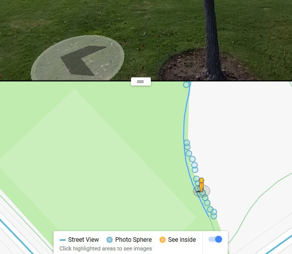
Did the Streetview app that used to work with the THETA (maybe it was V back then) ever automatically put the GPS coordinates into the video frames? I seem to remember making blue line uploads automatically…

Video Mode publishing Street View improved to 5.4K & 5FPS

Weren’t these uploads made with the THETA V 5.4K video at 5fps? My memory is not so good now days.

image

Also, does Streetview video frame extraction to automatic blue line work with other camera vendors?

@craig, I just got a reply from Ricoh support, they confirmed Theta Z1 doesn’t record continuous GPS tracks in any way for any video. But, they said it is just a software-level problem. With that being said, the github resource is incorrect in its statement about camm tracks.

The good news is - it’s an opportunity for a plugin.

@Juantonto , welcome to the discussion. I appreciate your contribution to this community, been following your posts for some time. You are doing an amazing job.

I apologize if it’s going to sound rude, but your statements are not 100% accurate.
MP4 file absolutely can have track data in it. It’s just a container. Google wrote the hole specification for this in an attempt to create a standard -
insta360 uses this camm spec to record continuous location data in video files. As a matter of fact, here is the thread from 2018 about the insta360 video file being successfully decomposed to find GPS info with ExifTool by Phil Harvey - I only wonder why a premium product like Theta Z1 doesn’t have this feature, since it has everything else to implement it.
Even if not inside mp4 files, the track can be recorded on the side (like some dash cameras do).

For enthusiasts of street photography, no matter if you are a Pro, pro, or hobbyist you will still try to save time on your workflow as much as possible. Time is the only asset we can’t “refill”. Naturally, people use products that allow saving time (and make more money of course, if it’s a paid job) with insta360 and other competitors like Labpano Pilot Era.
With this being said, video workflow seems to be the best method to create fast, inexpensive blue lines in street view.

  1. GoThru Street Builder is not free if you are up to something serious.


    As an alternative to upload, we can use Map The Path Uploader.

  2. GSV2JPG by Dean Zwikel will not work in the case of Theta Z1.
    image
    As a solution VID2JPG by Dean Zwikel can be used, but there is a caveat I’ll explain in my workflow below.

3.Using Theta basic app to take pics - something I did before, but it is not allowing you to take pictures faster than 6sec.. Accuracy is an easy fix - if someone is interested I can explain how to make it very accurate on iPhone or Android.

Boy it’s a lot of text already :slight_smile:

Here is my workflow to create content with GPS data using Theta Z1 for blue lines in street view
No photo editing included, I try to shoot in conditions that allow me to avoid post-processing as much as possible for non paid contributions.

  1. Android phone with specific settings in developer mode enabled for GPS accuracy.
  2. Specific settings in Theta basic app for GPS accuracy (for stills, since it doesn’t help with video :slight_smile: )
  3. GPSLogger app by mendhack to record GPS tracks in GPX file format for VID2JPG (the caveat).
  4. Use sequence - Start GPX track recording => Start video record in Theta app => Stop video record => stop GPX track record.
  5. Using GPS Track Editor - remove (automatic) noise from track and fix errors under tunnels and tree canopy.
  6. Using VID2JPG - create series of JPG files with GPS tags in them.
  7. With Map the Path Uploader - upload to Google Street View for Blue Lines.

One could argue about quality - but for google street view it’s super good enough if you are doing google a favor by making their product better with free uploads. Especially since they cut in half functionality of their app and discontinued the trusted photographer program. I would use the DualFishEye plugin to take stills for high pay jobs.

As you can see, this workflow can be reduced to two steps - Shoot the video, Upload with Map The Path Uploader if only we had Theta Z1 recording continuous GPS data.

@jcasman, @craig - how many manhours one would need to create a plugin for GPS records? A rough estimate of course.

2 Likes

I gave up on using street view native tools, since google removed much of the functionality from the app and doesn’t support the community the way they used to.

1 Like

At the current time, there is no way to plug a GPS unit into the USB port of the Z1 and have it work without manual security authorization every time you plug it in. (It’s not usable except for testing). There’s a long proof of concept here:

Plug-in Adds GPS Direct to RICOH THETA

As the Z1 does not have a GPS chip, you would need to pull the GPS coordinates from a mobile phone or other device. To do this, you likely need to connect the Z1 with bluetooth, which is possible, but not easy.

There aren’t easy examples for bluetooth exchange with the Z1 and a mobile app. However, the API is open and does appear to work.

Notice of website closure

Once you have the GPS coordinates into the camera with Bluetooth, the plug-in is a normal Android app running without a screen, so that part should be feasible with examples from Google, assuming that we can find examples with a normal android phone video file.

  • time to build transfer mechanism with bluetooth: unknown. Might take a long time
  • time to find Android example with normal phone: 4 hours
  • time to implement based on Android example (if it exists): 20 hours
  • testing and revision: 10 hours

The unknown part here is the bluetooth connection.
Also, we would need to find a good example on Android phones to use as a base. I’m not sure the example exists.

1 Like

@craig, I’ve seen your post with the hardware solution, it’s impressive, too bad we can’t pass it through in automatic yet.
Connecting via Bluetooth works out for me all the time actually, you are correct that it has to be done for accurate GPS data transmission. Here are screenshots for the Theta app to make it work. Bluetooth on the camera can be manually turned on by a long-press wireless button.

iPhone - no additional system settings required/available
Settings for Theta app

Android - turn on the option in developer mode.


Settings for Theta app

Thank you for the estimate, I added some updates:

  • time to build transfer mechanism with Bluetooth: unknown. Might take a long time - I believe this is already implemented in Theta android, since it works for still images, we just need access the method. Maybe this project can help
  • time to find Android example with normal phone - GPS-Video-Logger by Abin K Paul - this writes a separate GPX file - which is fine =)
  • time to implement based on Android example (if it exists): 20 hours - I used to code after university, but it’s been more than 10 years since. Wish I could help with this. Didn’t like Java anyway but it seems simple enough to put together existing solutions.
  • testing and revision: 10 hours
1 Like

I am the developer of GSV2JPG and VID2JPG. Those tools are intended to extract JPG files from videos. Instead, I would suggest using the VID2GSV tool in my UL2GSV tools for uploading to Google Street View in video format. The method would be to record a video using the camera and simultaneously record a GPX track using a GPS logger device or GPS logger app running on a smartphone. VID2GSV uploads the video to GSV and injects the GPS data from the GPX file at upload time. These tools are already available. See the summary below of the tools in UL2GSV and the link below to request access. I will approve the request when I see it.

https://drive.google.com/drive/folders/1U7youYqqE4JTriF37Ac52h29tQGxM2p7

5 Likes

@Dean_Z , thanks for posting this information. Do you know if the insta360 video files have the GPS information stored in the CAMM track?

If it has the data, I’m curious if there is GPS data every 10 frames or some spacing. Unless the GPS chips are built into the camera, there’s going to be a delay getting the GPS data into the camera in time to write it into the file.

@craig The Insta360 Pro, Pro 2 and Titan cameras store GPS data in the CAMM track. The Insta360 ONE series cameras store GPS data in the INSV file. The GPS data is recorded on a time frequency.

1 Like

@Dean_Z , do you have a mobile app recommendation for the Z1 that can record the GPS information on a mobile phone so that the person can use VID2GSV to get the images onto StreetView with automatic placement of spheres?

Also, if people build VID2GSV into their workflow, do you intend to charge for it in the future? If so, what types of price points do you envision?

Thanks for this information. The Insta360 Pro 2 has a GPS module in it.
image

For the Insta360 ONE, the INSV file format timestamps seem to be linked to the mobile phone GPS data or GPS Smart Remote.


For the THETA cameras, the easy solution seems to be to save a separate GPS data track on a mobile phone that triggers the video and then match the tracks up in post-production.

The more difficult solution in the future is to try and rally RICOH to add support for a GPS unit that attaches to the camera directly and adds GPS information directly to the video file in a standard format.

It’s not possible now to provide authorization to use a USB accessory on the Z1, but it’s theoretically possible for RICOH to modify the firmware to allow a physical camera button press to authorize the hardware accessory. There is no way to developers to do this now. It’s just a theoretical idea.

@craig For Android I would suggest the GPS Logger app. For iOS I would suggest the myTracks app.

UL2GSV is currently free to use.

Moderator edit: added link to UL2GSV here again for convenience

I do ask that users make a donation. Suggested amounts are:

$50 USD for an occasional user
$100 USD for a regular hobbyist or enthusiast user
$500 USD for a professional/commercial user

It’s not necessary to attach a GPS unit to the Theta Z1 cameras. A GPX track can be recorded separately as I explained previously and used with VID2GSV.

4 Likes

Hi @Dean_Z,

I tried to make contact re-payment via email (through googlegroups email), but can’t do that.

Can I DM you?

Thanks!

Martin Dunne

This is the link to donate to Dean Zwikel using PayPal

This is the main UL2GSV Google Groups

https://groups.google.com/g/ul2gsv

@Dean_Z , have you considered adding the donation button to the Google Groups information page?

To capture position for Google Street View or Mapillary, depending on the camera used, I am using for years already on Android OSMAND+.
There is a free version too.