I have experienced several days recently (June of 2020) when my Theta Z initially takes photos with correct, accurate GPS tags and then, (after taking about 39 photos) begins to have subsequent photos tagged with incorrect GPS tag.
Today, the first 39 photos I took had correct, accurate GPS tags. The next 76 photos I took were tagged with the GPS coordinates from photo number 39. The final 22 photos of the morning has no GPS tag information at all.
Has anybody else experienced this or can suggest what I can do to keep accurate GPS tags on all photos?
I have a similar problem: Theta SC, latest firmware, Android Pixel 3 phone with latest OS and latest Ricoh theta app. All that I’m trying to do is take 360-degree photos with GPS tagging, on mountain bike/walking trails, and then upload to Street View. However, I’ve found it pretty much random whether or not the photo is accurately located: it seems to be ‘binary’ ie accurately located or a few km wrong.
I know it’s not the phone: I’m resigned to taking a ‘normal’ photo with my phone (which is always accurately located) and then a Theta photo, knowing that I’ll probably have to adjust the location of each Theta photo during the SV publishing process, so at least I have a good location using the standard photo.
It’s such a shame that a decent bit of hardware (Theta SC) is rendered almost useless because of the badly-written app. And yes, I have uninstalled and reinstalled the app, no improvement.
I take the camera out of its pouch and turn it on;
I then start/resume the Theta app - and it always ‘forgets’ the camera*** so I have to reconnect each time;
Once the camera is connected, I can see the live view on my phone, press shutter release on the app;
And yes, I am careful to wait until the image is synthesised and downloaded to the phone, and the app reverts back to live view, before I switch the camera off;
I switch off the phone screen but leave the Theta app running.
*** This is yet another irritant - and it’s entirely the app, not my phone, which is happy to reconnect pretty much instantly to a known WiFi network. Looking at the Google reviews of this app, this is a common gripe, along with many, many vituperative and coruscating reviews of the app in general.
@jcasman or I should try and replicate this problem with either a Z1 or an SC2. The one difficulty is that it seems I need to take 50+ photos. Additionally, there may be other factors such as the camera dropping Wi-Fi and automatically reconnecting.
How should I test to see if the GPS information is accurate? Do I need to load the images up on streetview to see if the images are placed accurately on a map? Or, can I use some desktop software like a GPS map software on Windows 10?
Thanks for the additional workflow details. Can you confirm that you’re using an SC and not an SC2.
Unfortunately, I don’t have an SC, but the problem is likely with the mobile app, not with a specific model of camera.
Hi Craig, I really appreciate the help you’re trying to give me!
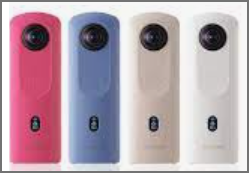
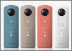
I definitely have a Theta SC - it was an ‘Argos discontinued special offer’ at £80, bought a couple of months ago: glad I didn’t spend more, given how disappointed I’ve been with the functionality of the app. And it’s definitely the app which is at fault; the details in my posts confirm this without any doubt.
I can see that the SC has the same photo resolution as the more expensive cameras (but lacks the video improvements) which is totally fine - my only intended use is 360-degree photos to submit to SV to help other mountain bikers (and walkers) what the trail is actually like.
When I take the 360-degree photo I can see that my location on my OS app on my phone is accurate; I know the area I’m in pretty well, so I can absolutely guarantee that the Theta app geotagging is very hit and miss. Easy thing to do is (as I describe above) to take a photo with the phone, which will have accurate geotagging (never, ever failed on my Pixel 3XL), then compare with the location shown when submitting the 360-degree photo to SV. I reckon less than half of my photos are accurately located and it’s either spot on or way, way out, often a few km away!
If I can’t solve this problem, the sheer aggravation of having to take a ‘standard’ photo before each 360-degree photo, to check/adjust the location, will probably make me give up and buy another make of 360-degree camera. I’m not asking much of the app: stay connected to the phone (fail) and get the geotag data from the phone (fail) and take the photo (pass). How difficult can it be?
the most recent version I can find is 2.1.0, updated June 10, 2021.
I’m going to go forward with a test with
Z1,
firmware 2.00.1
Android app 2.1.0 on Pixel 2
bluetooth and mobile data disabled on mobile phone
2.4GHz Wi-Fi
auto connection disabled to force checking if camera loses connection to Z1
location enabled
postview disabled (no transfer for images from camera to mobile phone)
Results
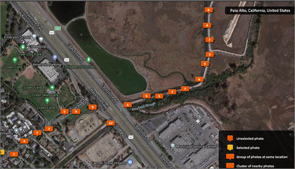
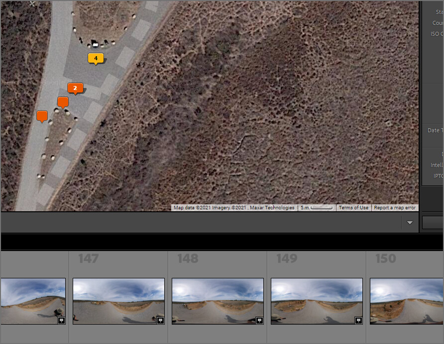
GPS data for 151 pictures looks accurate for most of the shots. There are zero pictures that show GPS off by several kilometers. break in the picture coordinates are due to a tunnel under the highway.
If the accuracy of GPS data is low, it is important to reduce the noise entering the GPS module of the smartphone.
The radio wave condition in the space around the smartphone changes depending on your hand, surrounding buildings, mountains, walls, ceilings, and automobiles.
Here’s one way to reduce noise.
And maybe the first questioner’s trouble is for a different reason than the GPS accuracy of the smartphone.
I often encounter this symptom when using the time-shift shooting plugin on THETA Z1.
If you take 20 pictures in a row, all the pictures may be assigned the coordinates of the first picture.
Alternatively, not all photos may have location information.
My problem is that it doesn’t behave the same every time.
I haven’t solved this problem yet.
It is only after I get home that I notice this symptom.
After that, I use a self-made processing tool that can write the location information to EXIF by looking at the GPS data and the time stamp of the photo that were acquired separately.
Thank you for this information. Does the problem occur if you take 20 pictures in a row with the time-shift shooting plug-in of the Z1? Or, does the problem occur if you take 20 JPEG images with the Z1 and RICOH mobile app (pressing the shutter button)?
I’m trying to figure out when the problem occurs so that I can try and replicate it and report back to RICOH.
It may be dependent on the GPS signal strength or the processing status of the camera.
When you write the GPS information to the EXIF data, how do you get the original GPS information? If the image doesn’t have it, do you go to a map and click on the spot with the picture was taken?
Also, nice tip you posted about turning off Wi-Fi information as a location information.
This tip from Toyo about using GPS status and toolbox app is also helpful.
t depends on the specification of the smartphone. If the Android users, GPS Status & Toolbox app would be helpful. And note that QZSS is great in Japan. I’ve never experienced
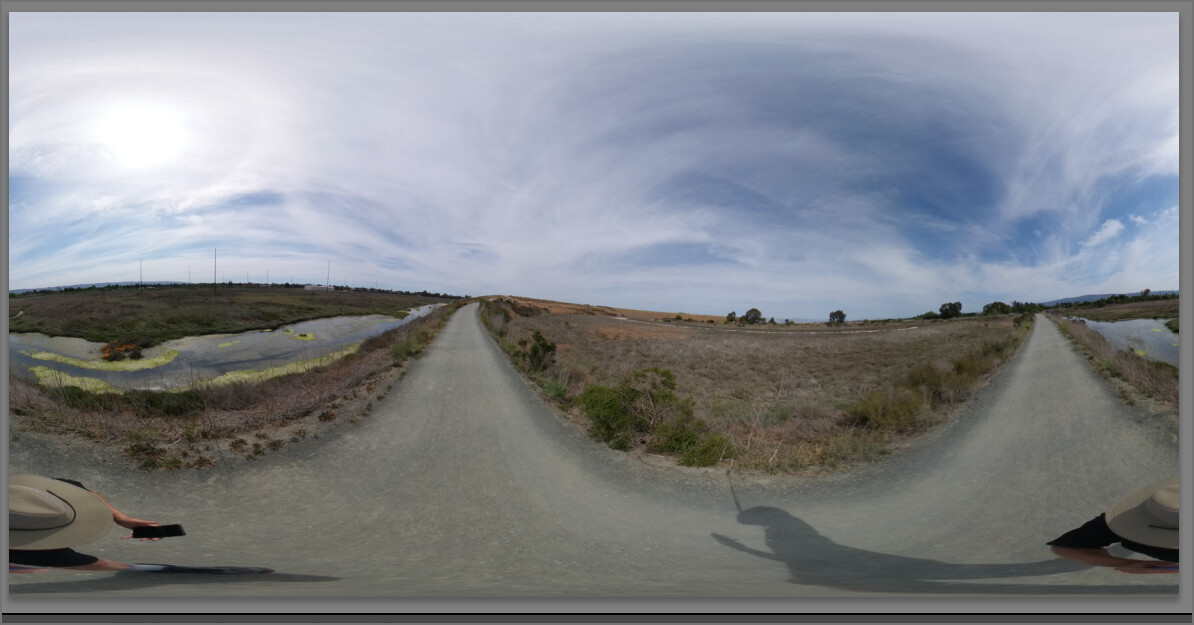
I put the 151 images into a 360° video sequence. You can see the position of my hand with relation to the Pixel 2 I am holding as well as the surrounding area.
The test is mostly free from GPS signal blockage and Wi-Fi interference. However, I did go through a tunnel at one point.
More input on the possible source of the problem.
Note that the SC has a slower processing time than the Z1. Maybe people need to wait 12 seconds between shots with the SC?
The SC processing time is not the issue - the problem I have occurs in my ‘usual’ shooting mode which has several minutes between the shots. It’s not a GPS reception issue, as my posts demonstrate, so I’m guessing it’s some failure of the app to extract the GPS info from the phone and/or failure to write the correct info to the image metadata.
I haven’t seen any update to the Theta app in several weeks - still on v 2.1.0
Oh sorry, I have a totally dumb Q (still getting used to this 360-degree stuff). Up to now, I’ve allowed the image to transfer to my phone and then, once home, submitted my images to SV using the phone, thus enabling me to check (and often, correct) the image location. If I don’t transfer the images to the phone when I take them, what’s the best workflow to then submit to SV?
You can use the mobile app at your office/studio to move or copy the pictures from the camera to your mobile phone after you take the pictures.
Alternately, you can transfer the images from the camera to your desktop computer with a USB cable and then use a web browser to upload the pictures to SV.
There are other software packages that you can use to upload from the desktop to SV.
As far as the GPS data being locked on one image. I have some theories:
If you are dropping Wi-Fi connection, and automatically reconnecting, the app may get confused
I have heard that Bluetooth connection between the app and the camera will also transfer GPS coordinates. I have not tried this.
you could try a test at a park with Bluetooth to see if you continue to get stuck with multiple images with the the same GPS data.
Thanks Craig. I could indeed load the images from the camera to my phone when I’m at home: I assume these images (if the Theta app works correctly) will have the correct GPS metadata?
I can find no information regarding submission to SV using a web browser - everything I read says “use the SV app on your phone” so please could you be a bit more specific?
For the theta SC, I can find no mention of BT connection with phone - only WiFi. And the reason for ‘dropping’ the WiFi connection is as explained in my post: I stop, take a photo, then take another one several minutes (perhaps 10s of minutes) later. Thus I have to turn the camera off for two reasons, both to conserve battery power, and to avoid unintended photos when the camera is in the pouch. What else should I be doing? Leaving the camera on all the time (which may be for 3-4 hours on my bike ride)?
The issue of the camera losing connection and having to reconnect is - as I’ve explained - peculiar to the theta camera and/or app. The phone will normally instantly reconnect with a known WiFI site, but I can never get the app to recognise the camera without having to use the app to reconnect each time - which is a real pain. That points to a problem with the app - which the reviews on Google Play Store confirm (the app developers should be reading these reviews and hanging their collective heads in utter shame and embarrassment).
I sometimes get multiple images with the same GPS coordinates, but that does not explain why some images are tagged with a new location some distance away.
I might try bypassing the theta app and see if I can connect a camera to the SV app and use that. If I do so, do I still get the chance to review (and perhaps correct the location) the images before I publish? However, I note that other posters on this forum have had trouble with the camera and SV app not cooperating…is that fixed and/or does it apply to the SC?
Just tried to connect the camera to SV on my phone: SV looks for the camera, asks to connect to its WiFi, have indeed connected the phone itself to the camera via WiFi, but SV can’t connect. So, it looks like the camera will never work directly with Street View, which is a real shame
Thanks Craig, but I’m unlikely to spend more money on this ecosystem until I can be sure that the issues are fixed. What about the other points I’ve raised? - any help would be gratefully received.
Unfortunately, I don’t use the Streetview app, so my knowledge is running a bit thin here. You may want to try posting to the Facebook Users Group. There are likely more SV photographers at that group. I think there’s also a Google forum for Streetview discussion. Make sure you mention that you’re using an SC. I don’t have access to that model, but there’s a ton of people out there using the SC.
Thanks Craig, much appreciated. Please can you comment on what I may be doing ‘wrong’ regarding the problem of connecting the phone to the camera? I can’t see any other option short of somehow keeping the camera switched on, which I don’t think would be intended when the shot interval is many minutes or 10s of minutes and thus the camera would be in its pouch.
Realistically, all of the problems that I, and others, are having regarding phone-camera connection and GPS accuracy will be a result of the Theta app not functioning correctly. It would be nice if the app developers at least acknowledged that these issues exist and commit to fixing them.