Introducing Street View Studio: The easiest workflow is coming to RICOH THETA users

Released!! Streetview Studio on May 23rd, 2022. “…a new imagery management platform from Google that was designed to simplify your workflow and solve some of the biggest challenges users have told us they face when uploading 360 imagery…”(written in Streetview Trusted Help)

Streetview Studio is the official web-based tool that anyone can use at free of charge. For more detailed infomations, see the public announcement in LocalGuides Connect.

How to use it.

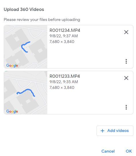
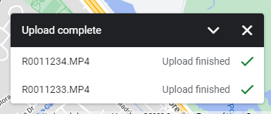
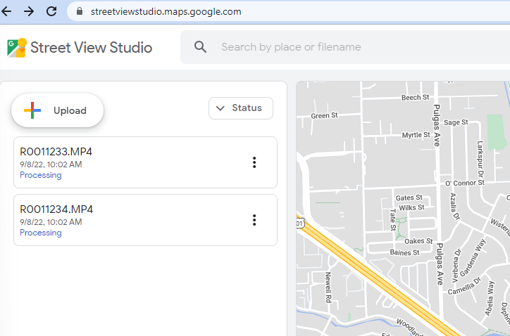
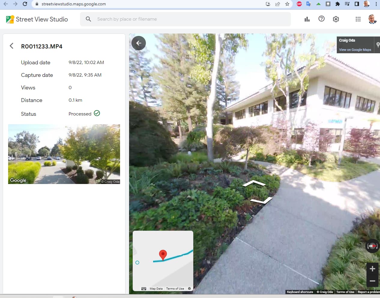
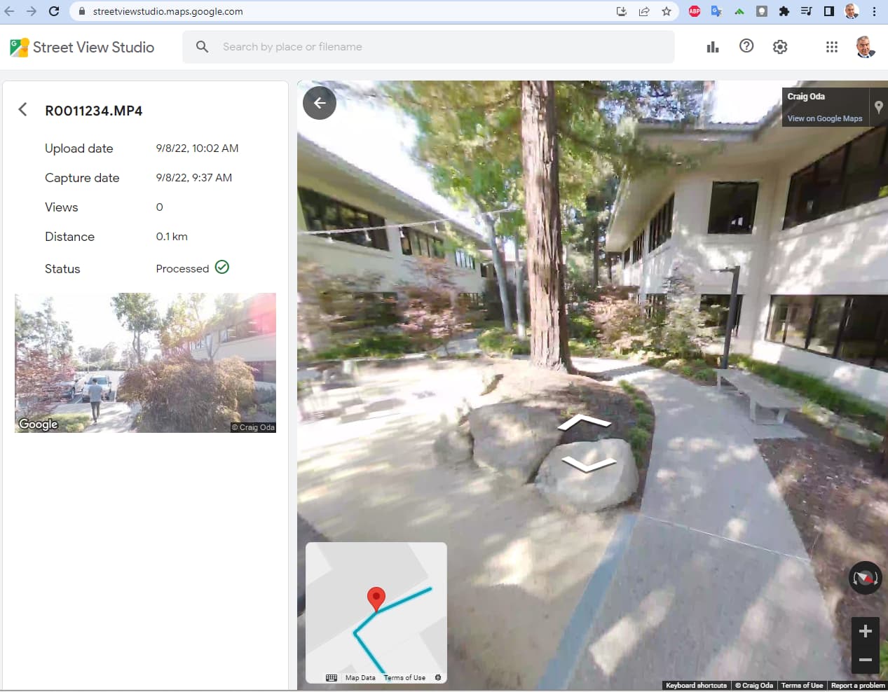
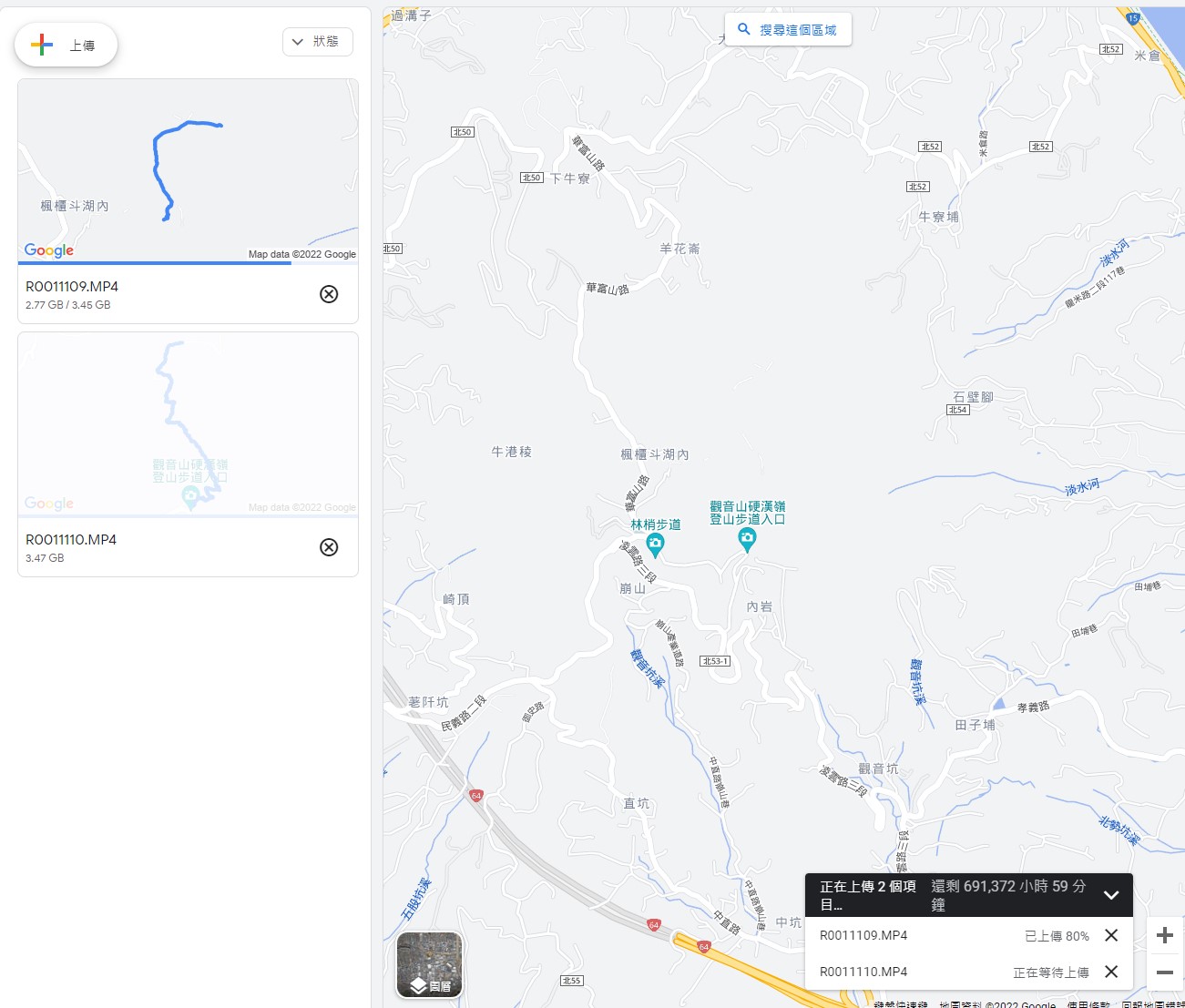
It’s quite simple. Just upload a video file(.mp4 or .mov) with geo location data and it automatically start proccesing of creating Blue Line on Maps.

Examples;

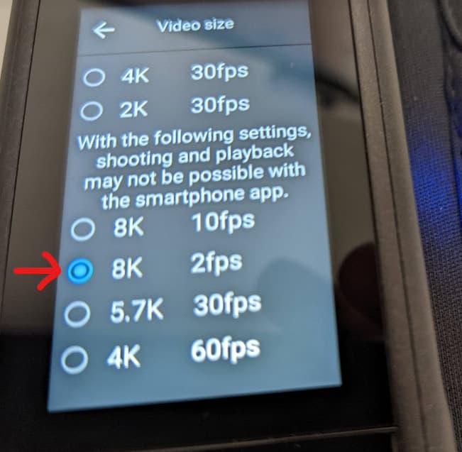
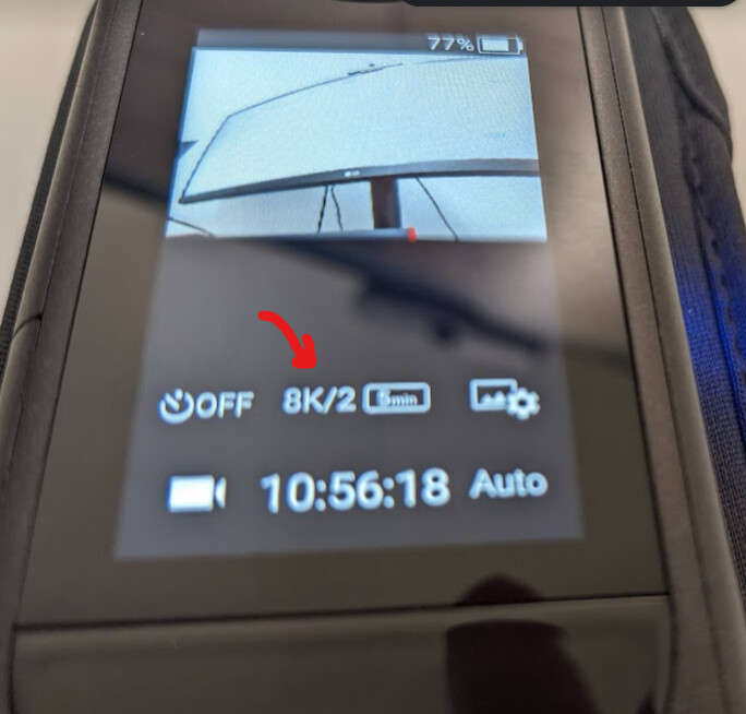
1.Mark Cummnis uses THETA X(8K 2fps 20min 2.32GB)

Video shooting in 8K 2fps is good for the hinking road. This format supports Google CAMM track. The plugin might enable us to directly upload the videos to Google. It’s the easiest workflow to make Blue Lines on Maps.

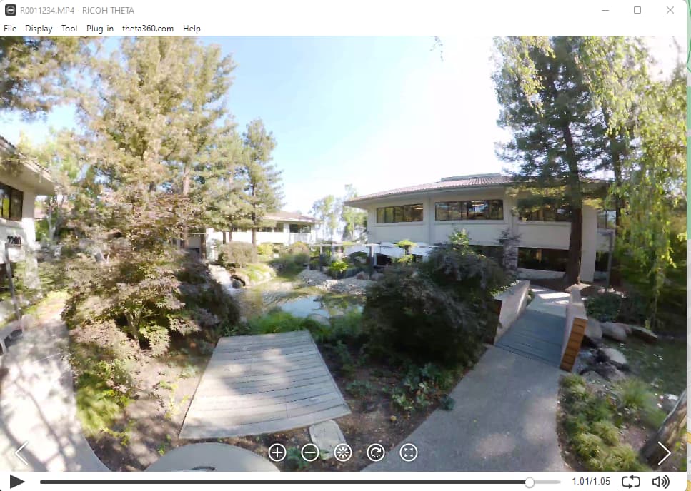
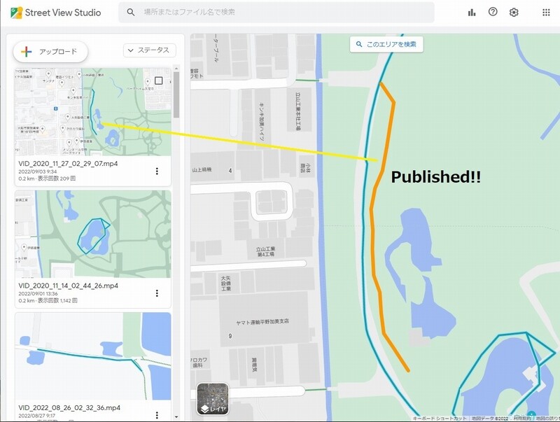
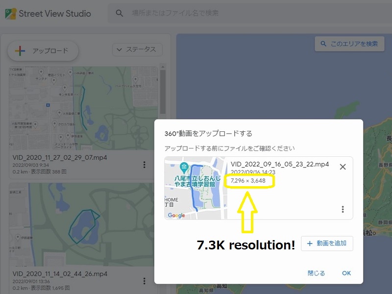
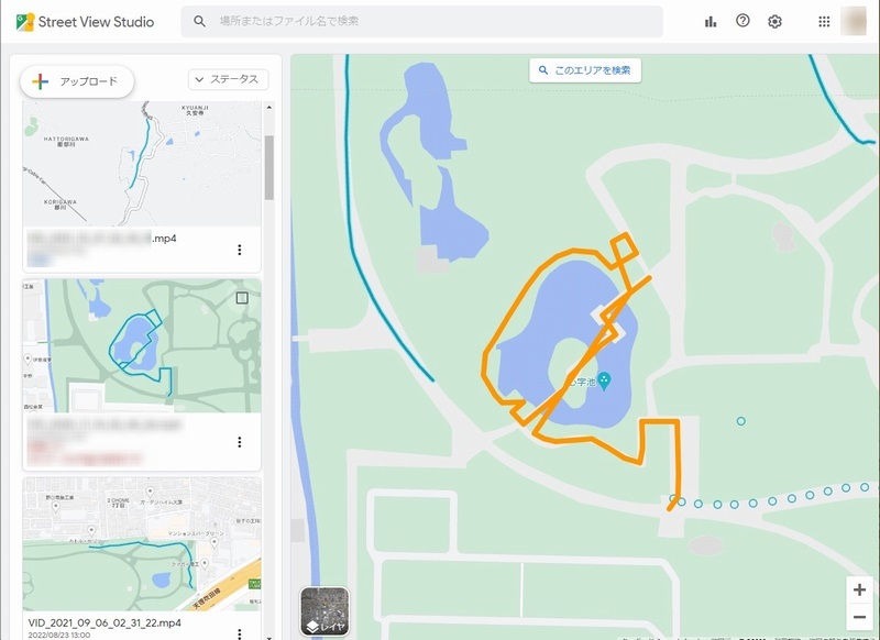
2.Toyo Fujita(Juantonto) uses THETA Z1(Single DNG)

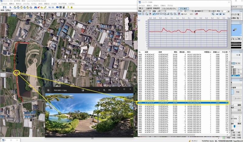
I captured the Streetview imageries above in 2020 and published them from GoThru. However the result got very sad due to “Dots”(not line) on Maps. The sequence seems to be so complicated.

sv_image2

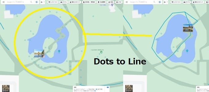
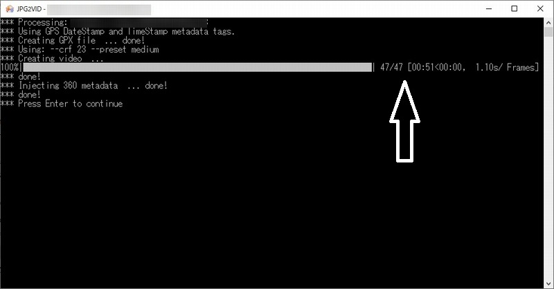
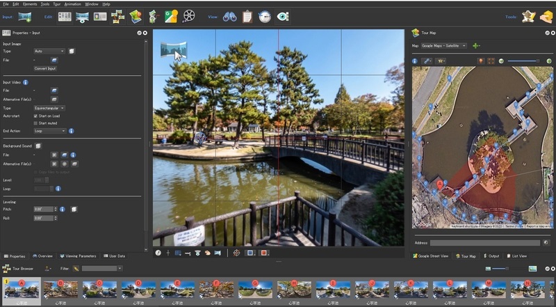
I can’t give up. Some of images deleted and re-aligned around the pond. And then, converted them into the video(.mp4) with using JPG2VID(tool of UL2GSV suite). The tool also creates .gpx file.

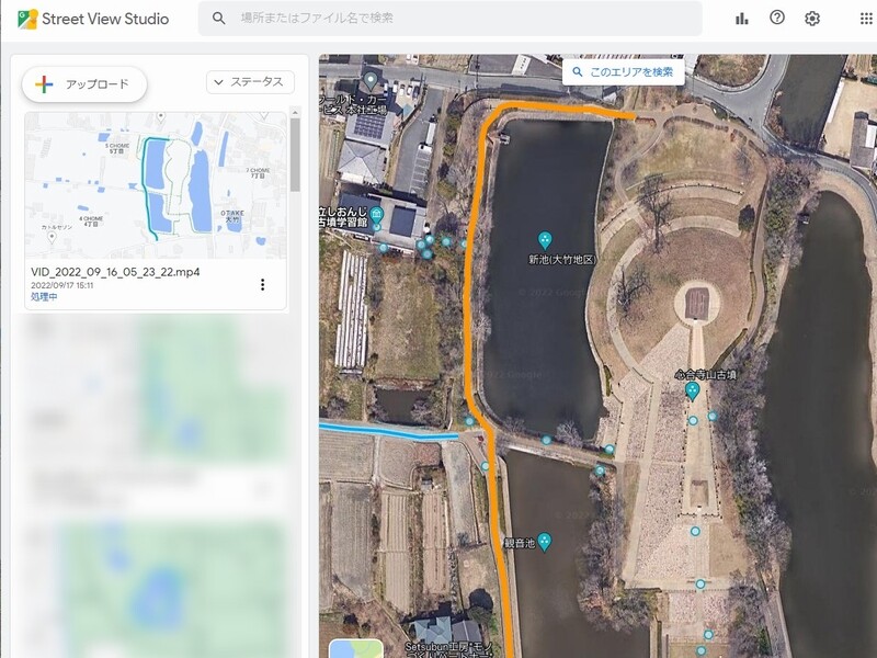
Now you can see Blue Line around the small pond on Google Maps. This is one of my success stories “Dots to Line” with using Streetview Studio.

You don’t need to pay any subscription fees. However, I donated to UL2GSV suite as an occational user.

X users should play with Streetview Studio. It’s cool.

Toyo

5 Likes

Thanks for this great article. Is there a general site for UL2GSV that people can go to get the software and assess donating to the project?

Is there something like itch.io or patreon where dean can show off UL2GSV and have it obvious that he’s open to donations?

RICOH THETA X Tests with Google Street View Studio

https://streetviewstudio.maps.google.com/

Test Setup

  • RICOH THETA X with firmware 1.20.0
  • 8K 2fps and 8K 10fps videos
  • internal GPS

Setting 8K video

Using body of camera. With camera in video mode, tap on settings button → Video Size

Verify 8K Video Settings

Must press button on body of camera to start video recording. Cannot use mobile app for the 8K videos.

Wait for GPS Location To Be Available

Establishing GPS Satellite Lock

The arrow needs to be a solid color.

Test Video Frames Prior to Upload

The video frames look fantastic in the RICOH THETA desktop app on Windows.

8K 2fps

8K 10fps

Upload RICOH THETA X Video Files to Google Streetview Studio

image

Wait for Video Files to be Processed

Started processing at 10:02am

View on Google Maps

Processing took less than 1 day

Google Maps

4 Likes

Hi @craig san,
How wonderful! You did the great tests with Streetview Studio.
AS I expected, X can provide us the quickest and easiest workflow to make Blue Line on Maps.

Have you also tested the Assisted GPS(A-GPS)?
Yesterday, the new 360 camera released from Insta360. It also has 8K Timelapse feature and large display. But no internal GPS.

BTW, my final attempt to make Blue Line with Z1 is shown below.
Captured 40 SingleDNG images at 27th. Nov, 2020.

You can enjoy the video created in JPG2VID(UL2GSV Tool Suite) . Here it is.
Tons of thanks for your supports.

Toyo

3 Likes

THETA X 8K 2fps and 8K 10fps videos were published after less than 12 hours processing.

THETA X 8K 10fps test

  • internal GPS

THETA X 8K 2fps

2 Likes

Hi @craig

These seem like very short distance and duration recordings. Real world, professional, Street View recordings are 30-60 minutes and longer and are often done in climates with higher temperatures. Have those scenarios been tested with 8K 2fps and 10fps? I’m curious if the Theta X can perform in those scenarios.

Thank you

2 Likes

Thank you for your advice on the workflow to test in future. I have not done adequate testing, so I cannot provide an opinion on the heat outdoor in the sun. I tested the 8K 2fps video for 25 minutes indoor. See below.

I’ll try a longer test in the sun in the future.

2 Likes

There’s no hurry, @Dean_Z.
X is not a camera for the professional photographers.
However the easiest method will contribute to increase the UL2GSV users.

Fingers crossed.
Toyo

Hi, @craig san
Surprised with the proccessing time… 12 hours is so fast.
But the longer duration video may need to take longer time.

Thanks for your testing.
Toyo

1 Like

@Juantonto

It’s not necessary for Theta X users to use UL2GSV. Theta X videos contain a CAMM track and can be uploaded directly to Street View using Street View Studio.

2 Likes

Hi @craig

UL2GSV is available by joining the Google group at the link below. I use the Group to maintain a list of people who have downloaded it so I can notify them of problems or upgraded versions. There are currently over 1100 people. The software is free but I do ask people to make a donation.

https://groups.google.com/g/ul2gsv

3 Likes

Please also try a longer testing using 10 fps. 2 fps is OK for walking and slow speed vehicle recordings. The bulk of professional Street View capture is done using automobiles at higher vehicle speeds so 10 fps would be required. The target frame spacing is 3 meters. So, 2 fps equates to 6 meters per sec maximum travel speed (22 kph) and 10 fps to 30 meters per sec maximum travel speed (108 kph).

2 Likes

I’m continuing my tests with shorter video clips to confirm that the THETA X video formats work with Google Street View Studio and if the GPS information from the THETA X built-in chip is accurate.

So far, it looks accurate outdoors in places with limited trees. I’m comparing the map to the image in the picture to assess accuracy.

2 Likes

The advanced workflow with using THETA Z1(7.3K resolution)

Hi,
@craig san’s tests tell us 8K 2/10fps video of Theta X would be the best solution for using Streetview Studio. However, the image quality is far from satisfactory.

I think 7.3K(Theta Z1) Blue line is awesome. The workflow is more complicated a bit than that of X.

  1. Connect Z1 with Theta Basic app iOS/Android.
  2. Shoot Single DNG images.
  3. Selected Mode is ISO Priority. Handheld HDR is no good.
  4. Develop in Lightroom Classic one by one and batch stitching in RTS.
  5. Export JPGs and remove the ugly shooter.
  6. Drop them onto JPG2VID
  7. Upload .mp4 and .gpx files from Streetview Studio
  8. Proccessing… takes 24-48hours to complete.

Examples ; Capture date: 16th. Sep,2022 2pm JST
47 shots ISO100, 0.3Ev with using the monopod(MT-58) on the path in the ancient tomb(Shionji-Yama)

Video files here; RICOH THETA
11 of 47 images are uploaded to theta360 website due to the restriction(less than 5MB).

  1. JPG2VID created .mp4 and .gpx files to be uploaded to
    Streetview Studio.

  1. The video file is 7.3K resolution.

  1. The GNSS information is very accurate and 1Hz track log.

  1. Streetview Studio can accept those files without plobrems. Now proccessing…

The brand new 7.3K Blue Line on Maps is coming in about 24-48 hours.
Stay connected.

Toyo

PS.
img5_2022-09-17

Street View Trusted Help Center says, “If you have any issue, try to reupload. It’s fixed.”

3 Likes

Great quality in the shots. What is RTS? is that some type of batch stitching software that works with the Z1 DNG images?

What improvement does the ISO priority, ISO 100 bring?

I’m still learning how to use ISO properly.

1 Like

thanks for the info it’s very cool

1 Like

It’s Ricoh Theta Stitcher. Here it is.

Published!!

Toyo

1 Like

This is my test

8K 2fps

3 Likes

looks very good in my opinion. Did you edit the frames after you took the video?

There’s a bright sun in the image. Did you delete the lens flare (red dot) out?

Did you use EV compensation or brighten the image after you took it? I would think the sun would impact the light sensor and make the scenes under the trees darker.

The lighting is very good in your Street View creation for a tough scene with many shadows and light.

great job.

I not use any edit , it original 8k setting
Auto ev iso max 3200.

Next time i will try limint iso to 800 to keep quality.

8k 2fps is a very good format to capture google street view data .

I have share a post here.

here https://www.mobile01.com/topicdetail.php?f=252&t=6665175

If thetaX can auto loop rec,and auto aeb

Any VFX/CF movie studio will love it.helped us a lot.

2 Likes

Thanks for posting the article.

Your workflow involves taking the battery out of the THETA X and using the ULANZI BG-3 to power the camera to reduce the heat of the internal THETA X battery.

With this technique, how long can you record 8K 2fps video before thermal shutdown occurs? Maybe thermal shutdown does not occur?

What do you mean by “auto loop rec”? Is that for interval shooting of still images? Or, video?