*
Hi, GSV freaks!
I’ve been testing the web-based tool on Teliportme.com to publish the virtual tour for Google Maps.(not Blue Line)
|
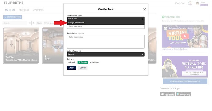
"Create Tour" panel on Teliportme.com
Log-in to the Teliportme.com and give the permission to your Google account. Then, you can create the tour page on your dashboard.
|
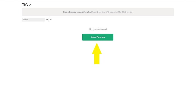
"Upload window" page on Teliportme.com
Upload your panos.
In this case, I took 7 spherical panoramas with using In-Camera HDR/RAW mode of THETA Z1. You don’t need to connect with the phones. Just click the shutter button. That’s 360 cam. Any of 360 cam should be easy to shoot for everyone. Because…
|
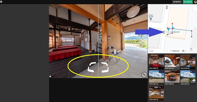
"Edit" page to connect and aling panos on Teliportme.com
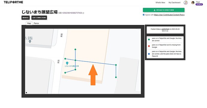
You can easily and visually connect and align those uploaded panos. That’s why you don’t need GPS data. You can re-locate them as you like. Of course, the constellation can be moved and rotated.
|
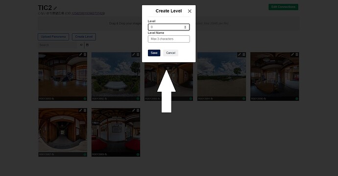
"Create level" panel on Teliportme.com
If you’re a professional 360 photographer, one of your clients(Hotel, Clinic, Super-market,…and etc.) may request you to make the multi-stories GSV tour. No worries. Teliportme.com supports “Levels” since the first released version.
|
"Manage and Publish" page on Teliportme.com
Also you can update the metadata anytime. For example, re-align, re-location the specific pano and change or adjust the FOV.
Conclusion;
Teliportme.com SV editor may not be the best tool for the time being. It’s just started. However, our feedbacks will make it improve the usability more and more.
After shut-down of Google’s SV app, this is the awesome news for us. There’s no reason we don’t give it a try!
One more thing.
I’m not a man of Teliportme.com, just a tester(non-affiliated). Vineet Devaiah is the man! If you have any questions, just contact him.
Good luck!
Toyo
Google Maps

