Help Improve Craig's Street View Workflow

I’m a novice photographer. Inspired by @Juantonto in the discussion in the dual-fisheye plug-in topic, I’ve decided to improve my 360 photography.

I’m having some problems and I’ve learned some things.

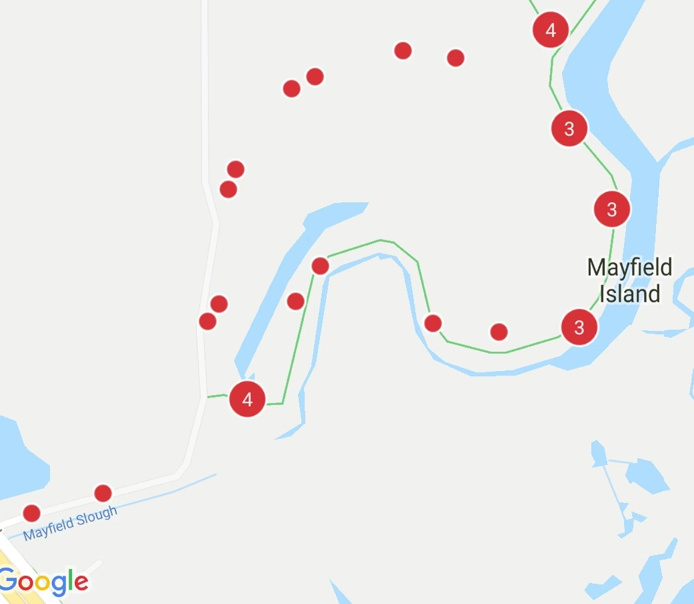
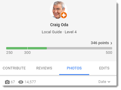
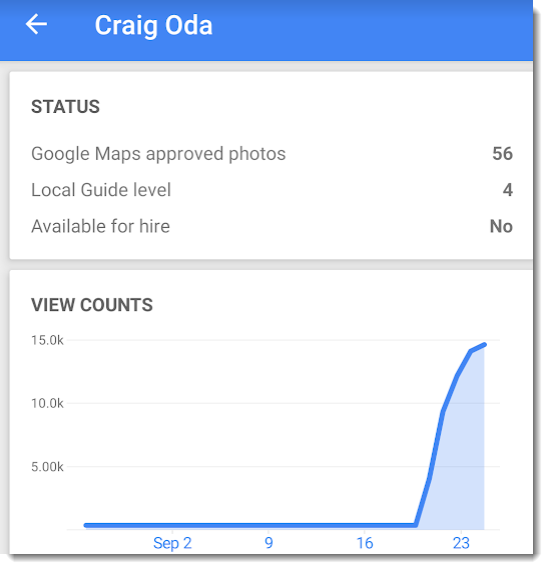
After a few weeks, I’m a local guide Level 4 and have 56 of 67 photos approved for Google Maps.

image

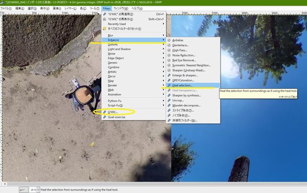
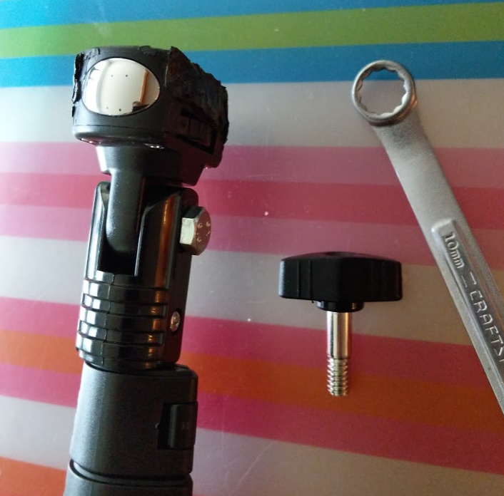
Tripod elimination workflow

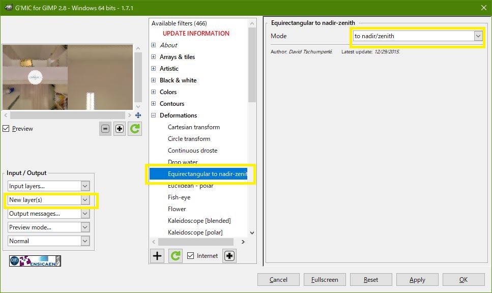
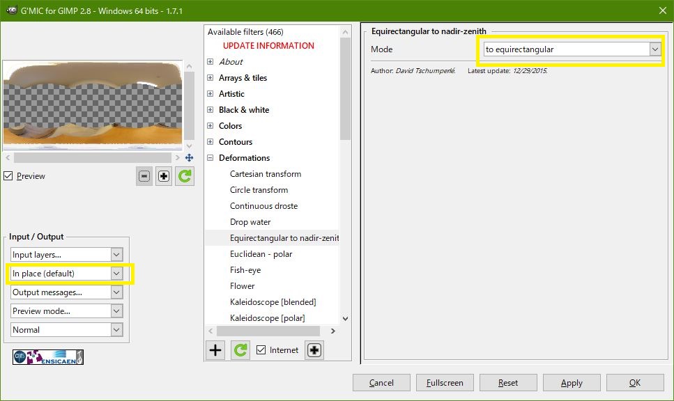
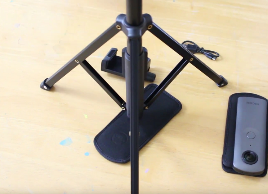
I can eliminate the tripod and tripod shadow with the heal feature of GIMP. This takes a while and I’m wondering if I should buy a tripod with a smaller mount point.

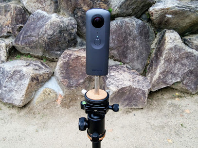
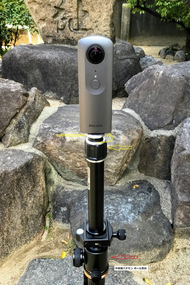
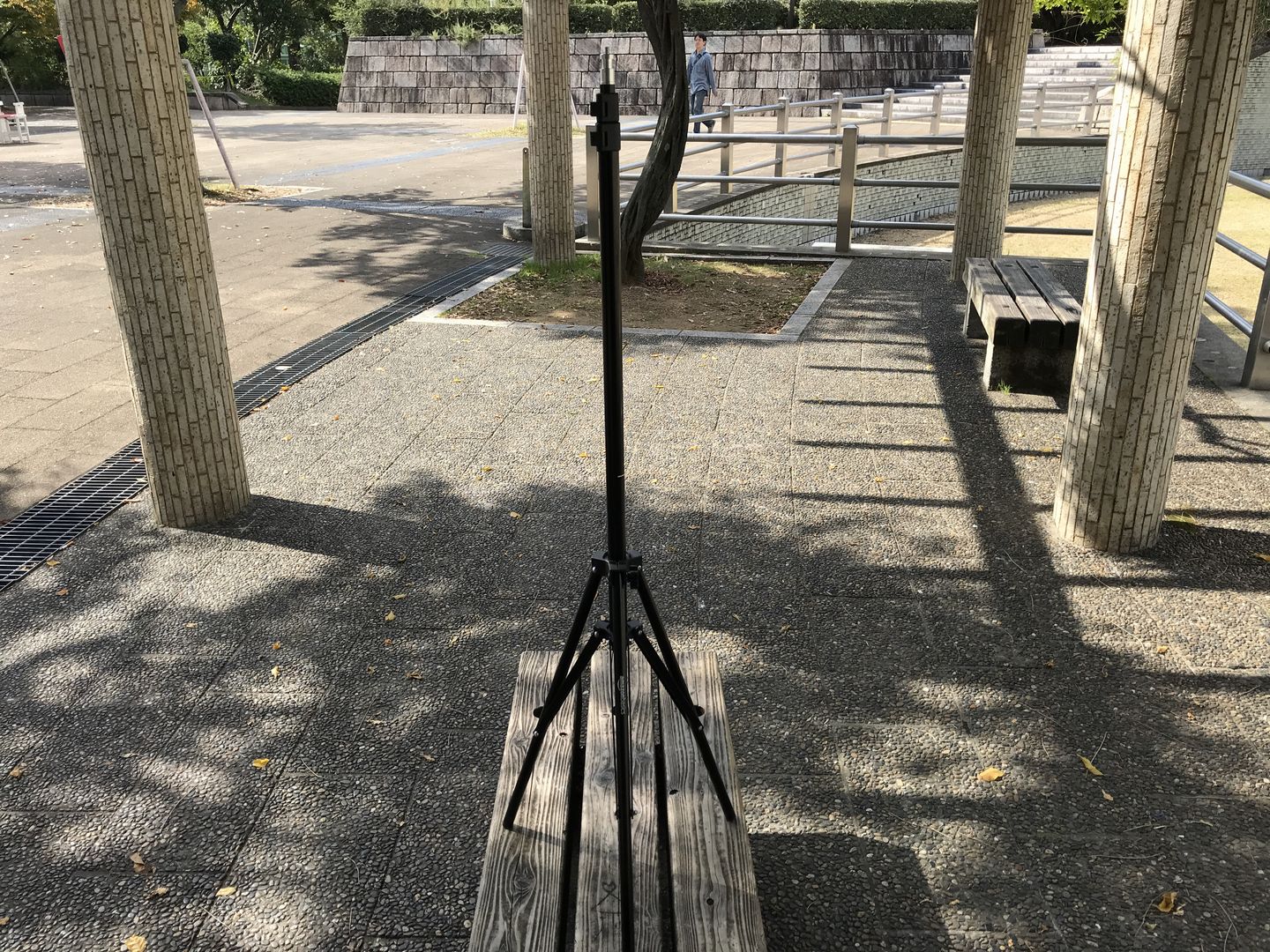
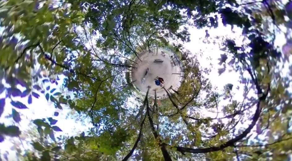
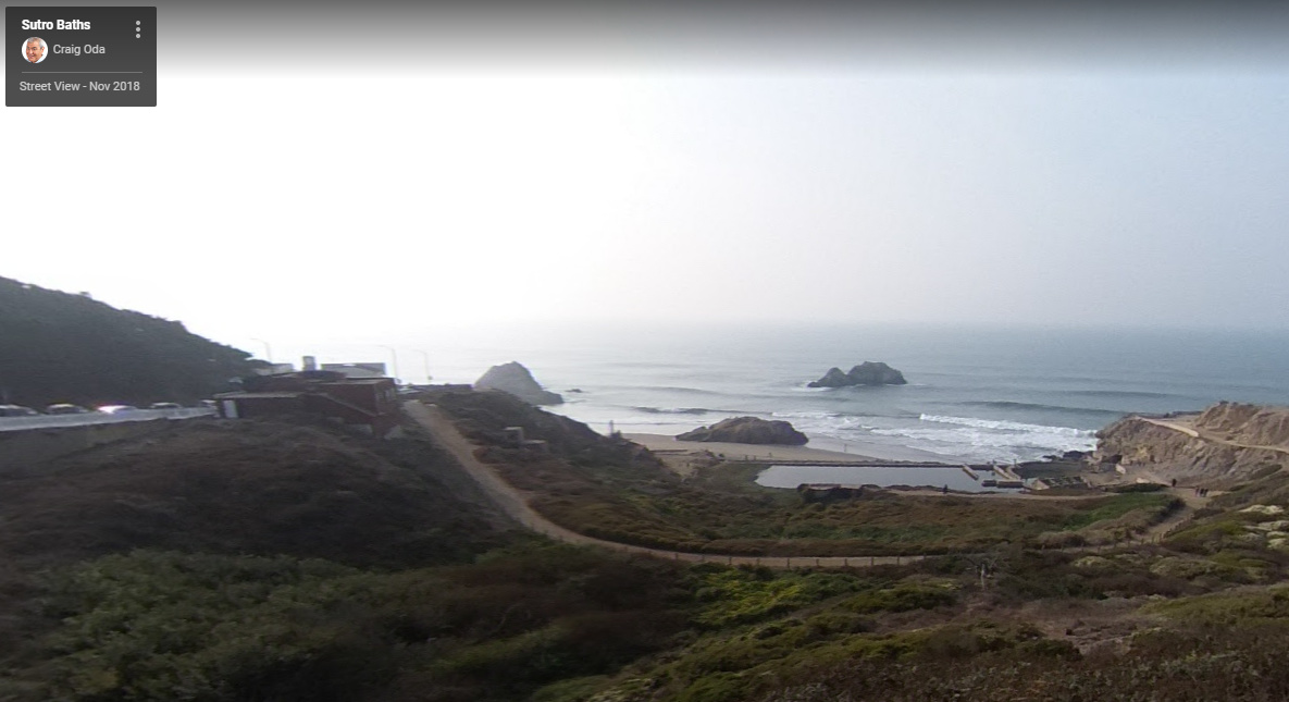
Example of tripod eliminated with GIMP.

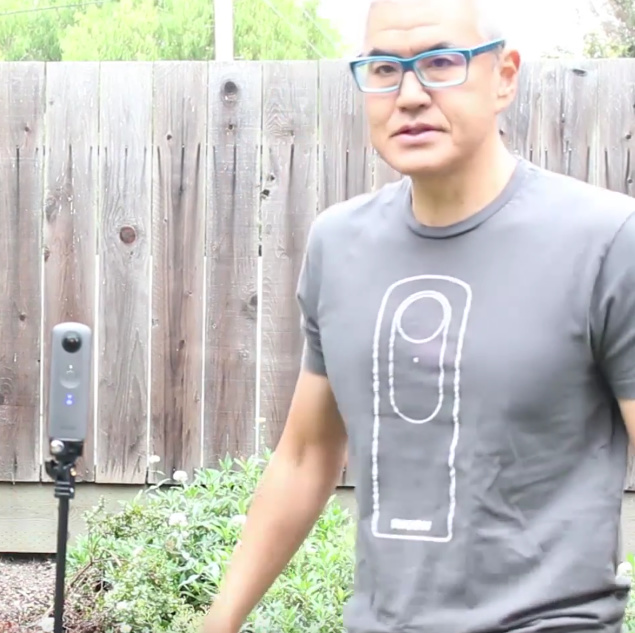
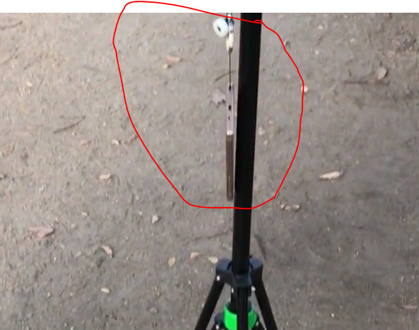
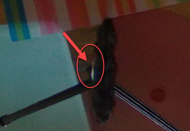
In this type of shot, the tripod is visible.

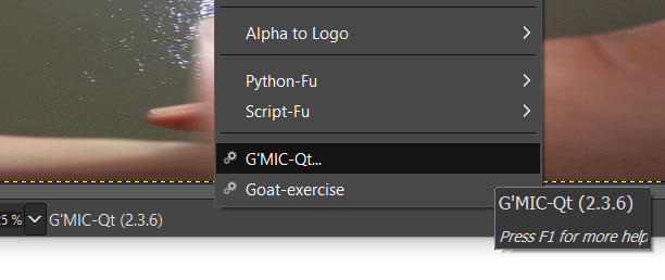
The red dot is easy and quick to eliminate with GIMP. However, the tripod takes me more time to delete.

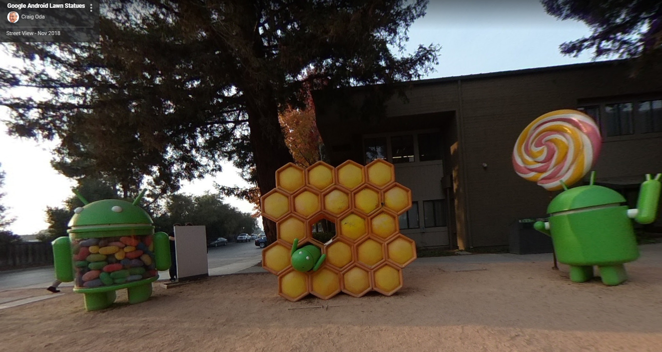
Linking images workflow

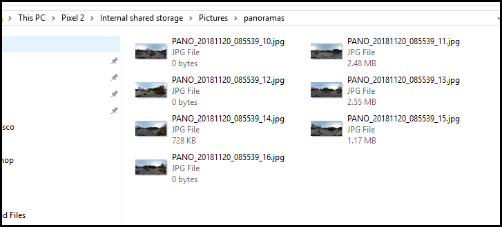
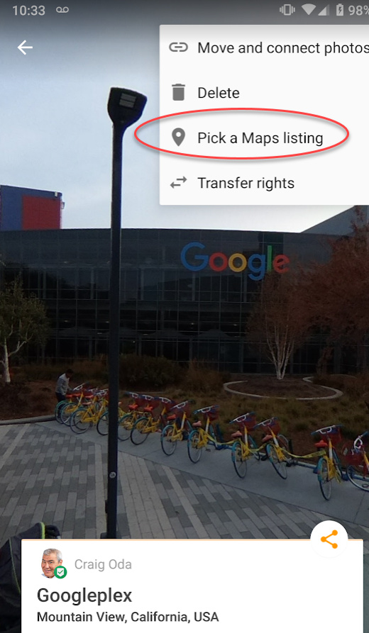
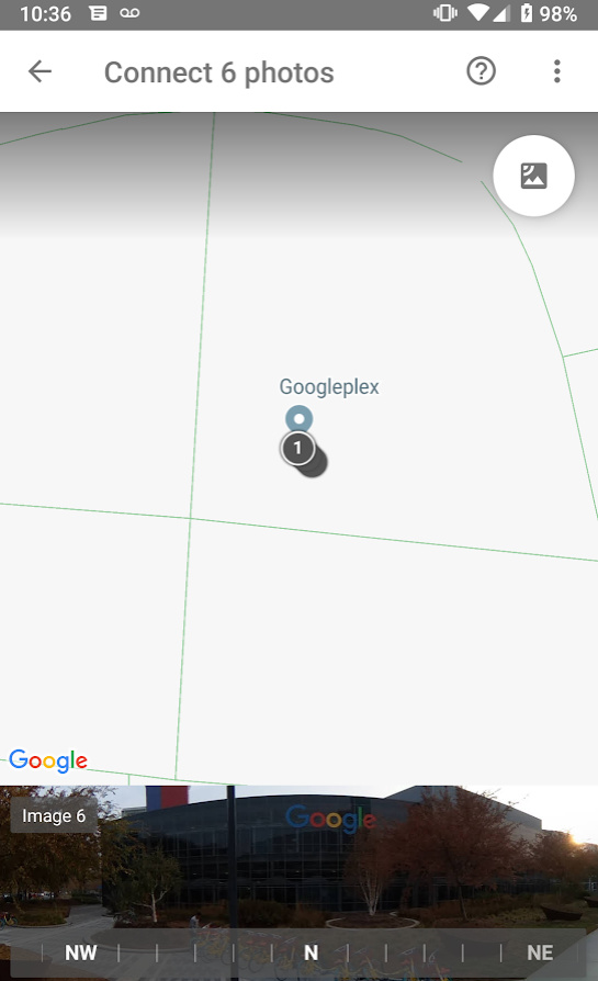
I don’t understand how to link the images. I’ve taken four shots at a local medical center. Do I need to use something like Pano2VR to create the directional linking?

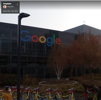
The following two images can be linked.

Using Mobile App

I’m using the Ricoh mobile app outdoors and find it inconvenient to connect to the THETA V for a quick shot. I’m thinking of building plug-ins for different workflows so I don’t have to fiddle with the mobile app.

Self-Timer Delay

Using the Android app, it seems like I can only set the self-timer delay to 10 seconds maximum. Am I missing a setting in the app? I think I prefer 20 seconds so that I can hide behind a tree. The WiFi API seems like the maximum value is 10 seconds, but I can easily create a longer delay in the plug-in.

Multiple Shots While Walking

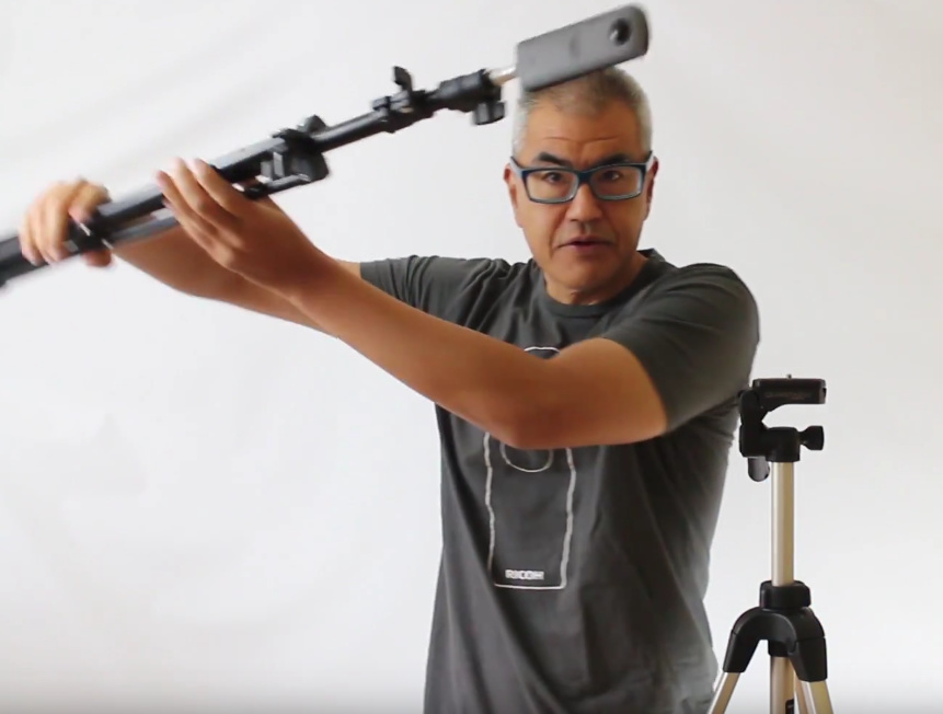
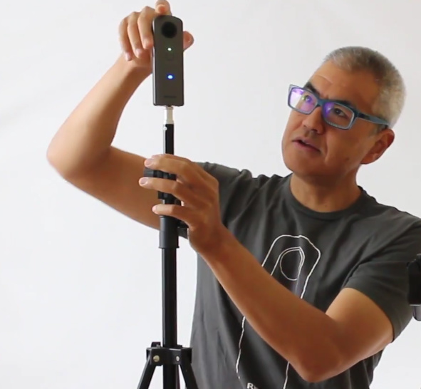
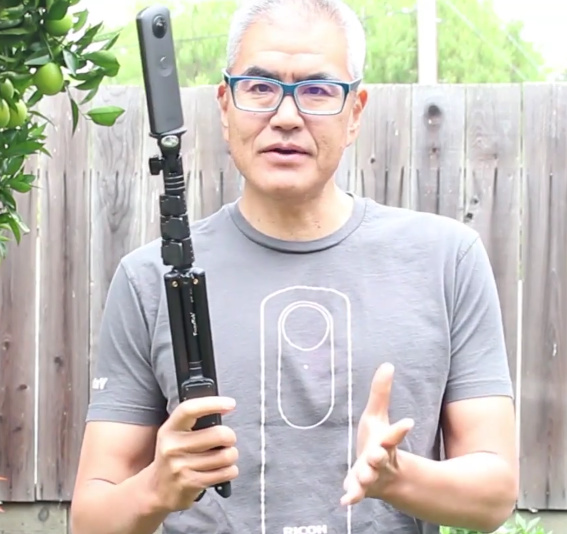
I’m thinking of putting the THETA on a selfie stick and going hiking. While the mobile app does support a good range of interval shooting, I don’t want to use the mobile phone for the setup. I would prefer to just have a plug-in that has the specific interval I like to use for walking and taking Street View pictures.

If I want to take 20 Street View pictures in a row as I walk down a path, what is the best time delay between shots? Do I need to have the GPS coordinates for every shot?

At the current time, I don’t know how to link the images, but I feel that I will figure it out eventually.

What I learned

  • HDR and normal shooting look the same to me in bright light conditions outdoors
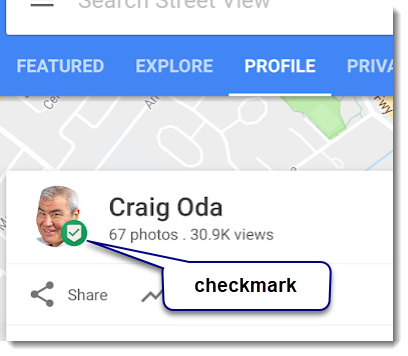
  • It’s better if I blur the faces on people. I’m using GIMP to blur the faces right now, but may move to the automatic facial blur plug-in
2 Likes

Congratulation! @codetricity
Welcome to Google Street View Trusted Photographers’ world.

I usually use GIMP + G’MIC plugin to clean the nadir.

GIMP20_2

And putting such “extension” under the camera may avoid making Big tripod.

DSC_0457_s

You can use the connection editor in Street View app both iOS and Android. Try to use it first. Using “Chrome + Vysor” would be better than the manipulation by the sausage finger.

However, the current version of Street View apps are facing the serious problems as below.

For iOS app,
Known issue; Image Blank on conection editor.

For Android app,
Known issue; Frozen compass slider.

Notes:
Street View Discussion board in Connect is exclusive. Login with SVTP account is required. We have lots of things there.

I’ve been using Pano2VR Ver.6 since last December. It is very good, no ploblems. The third party tools(GoThru,Panoskin,Pano2VR,…etc) are needed for adding Elevator Widget.

Caption; Tap or click the floor label at the right side of image.

**** iOS Google Maps app does not display it.**

Theta V resolution increased to 5.4K

Video Mode publishing is the most advanced technique in Google Street View. Now it is still beta service. Google needs our feedbacks more and more.

Caption; Video Mode publishing with THETA V + the latest SV app Android.

Hope it helps.
Toyo

2 Likes

@Juantonto, thank you for this help. I will go through the tips one by one. I had never heard of G’MIC before and am now looking at it.

http://gmic.eu/

Coincidentally, I was talking to @jcasman yesterday about graphics libraries similar to ImageMagick and it looks like G’MIC would be a good addition to the list.

I still need to figure out how to use it. Is there a specific filter in G’MIC that you are using? My interface looks different from your screenshot. I wonder if I am using the same plug-in.

Download

image


Street View Trusted Photographer

Update: 2018, October, 02

I think I’m now part of the Google Street View trusted photographer program.

image

I also received this email.

1 Like

Hi, Congrats! again. @codetricity

I always use the former version of G’MIC. GMIC-QT is the latest one. It is better for you.

pic.1


Load the image. Click Filtes => G’MIC

Set the parameters as below(see pic.1).

  1. Input / Output => New layer(s)
  2. Available filters => Equirectangular to nadir-zenith
  3. Equirectangular to nadir-zenith => to nadir/zenith

Click OK and select the new layer and edit nadir by using “heal selection” or so.

pic.2


Click again Filtes => G’MIC

Set the parameters as below(see pic.2).

  1. Input / Output => In place(default)
  2. Available filters => Equirectangular to nadir-zenith
  3. Equirectangular to nadir-zenith => to equirectangular

Click OK and wait a moment. Processing time depends on CPU power.

pic.3

Merge down the new layer and overwrite the file. Check two options to save Exif and XMP data. This is very important.

That’s all.
Sometimes it is easier to edit nadir with using Polar coordinates.

Good luck!
Toyo

P.S.
These are useful threads in the SV discussion board on Connect. However, almost all of them are written in the weird Japanese. Feel free to ask me and tag me(@love_ikoma_toyo) there.

https://www.localguidesconnect.com/t5/Street-View-Discussion/RICOH-THETA-V-SC-S-の情報交換/m-p/409445

https://www.localguidesconnect.com/t5/Street-View-Discussion/TIPS-Street-View-App-ストリートビュー-アプリを使いこなす/m-p/289868

https://www.localguidesconnect.com/t5/Street-View-Discussion/サードパーティー製デスクトップツールに関しての情報を交換するスレ/m-p/246942

https://www.localguidesconnect.com/t5/Street-View-Discussion/SVAを使い-THETA-V-の動画モードで一気に40分間の連続撮影をしてストリートビュー作成/m-p/651422

https://www.localguidesconnect.com/t5/Street-View-Discussion/PTGui-初級者偏/m-p/253099

https://www.localguidesconnect.com/t5/Street-View-Discussion/Tips-Nadir-天底-の処理について/m-p/243249

https://www.localguidesconnect.com/t5/Street-View-Discussion/HDRでおさえる意味と手法について/m-p/249018

https://www.localguidesconnect.com/t5/Street-View-Discussion/日本語による情報交換の場について-自己紹介など/m-p/239733

https://www.localguidesconnect.com/t5/Street-View-Discussion/Started-RICOH-THETA-Plug-in-Partner-Program/m-p/947976

2 Likes

Great information! Thank you for posting @Juantonto

2 Likes

This past weekend, I went to San Francisco to take Street View pictures.

I used a light stand for the trip. It took good shots, but was a little bulky. To assess better tools and potentially identify prizes for the November microconference in San Jose, I reviewed a $22 selfie stick with legs. It is made by Fugetek.

Light Stand

Selfie Stick

I’m now up to 91 pictures, 64,996 views, 465 Local Guide points. I’m at Level 4 now.

Update October 26, 2018

I had a small failure due to my lack of knowledge of how Google Street View links images. I went on a hike to try and record a trail.

I originally thought that I could make long connections. After uploading the images, I realized that the images needed to be in close proximity to each other. In the example above, I can’t link most of the spheres.

I documented my evaluation of the tripod and my hike in the video below.

I’m now uploading a 3GB Street View video at 5.4K resolution to try and get the automatic disassembly of the video into individual images and the automatic linking of the image spheres. From reading through the material on the Google Street View forum, this is what people appear to be doing to link the spheres.

If this works, it may be possible to use the dual-fisheye technology to take a picture every second and thus reduce the video size by a factor of 5. Ideally, I wish I could record 5.4K video in the plug-in, but I have not been successful. If Ricoh makes that open in the future, then I could set the fps to 1.

I also used a soldering iron to melt down the tripod base and make it smaller. What I really need to do is change the top thumb screw to a smaller 1/4" by 20 tpi bolt.

My tripod base modification is documented here:

1 Like


Hi, @codetricity & @jcasman

As you know, I’ve recieved early X’mas present from two uncles.
Then, I bought “Aluminium 7 Feet Light Stand with case” from Amazon.com, not Amazon.co.jp.

Your photo & review were very shocking. You use light stand as if it were a sword “刀(katana)”. Very cool!!

Enjoy my video, but it is spoken in Japanese to share it in the Japanese community of Connect.

Thanks,
Toyo

Oops, this is test shooting with Light Stand.

1 Like

This is a great review. Thanks for posting it.

This is a cool effect to put the camera in a tree high up.

In the screenshot below, are you using the mobile phone connection to the THETA with self-timer mode?

image

I heard that @Svendus is using a Bluetooth controller to trigger the shutter of the THETA by connecting the Bluetooth controller to the mobile phone. I want to experiment with using this technique of leaving the phone close to the camera.

In the shot below, I am holding the stand horizontally over an open space ina UNIQLO store

I replaced the thumbscrew on my selfie-stick and reduced the tripod size in the picture.

image

1 Like

I field-tested my tripod modification and am happy with the results.

I’m now a level 6 local guide.

image

Thanks to everyone for the tips. The Google Street View community on Local Guides Connect is incredible.

I want to share my recent experience with everyone as it might help other people.

On Sunday, I planned to take a hundred Street View pictures across these locations:

  • San Francisco
    • downtown financial district
    • Nob Hill
    • Lands End
    • Sutro Baths
    • Conservatory of Flowers
    • Golden Gate Park
  • Silicon Valley
    • Googleplex
    • Android Lawn Statues

I ran into a number of problems, had some success, had fun, and learned some things about the THETA V and Google Street View.

image

Challenges

The main problem I encountered was that I forgot to upgrade the THETA V to firmware 2.50.1. I had updated my Android Pie OS prior to the shoot and learned that the new Android Pie OS update was not compatible with the 2.40.2 in my equipment configuration. I was not able to send commands to the THETA V with either the THETA mobile app or the Google Street View mobile app.

My phone is a Google Pixel 2. After the shoot, I was able to upgrade the THETA V firmware and desktop application. However, this was not until I returned home. I unfortunately didn’t bring my laptop to the shoot.

During the shoot, I was not able to change the camera options or attach GPS data to the images.

Lessons Learned

Desktop Versus Mobile Uploads

I was not able to upload the Google Street View photos from my laptop. The images would not appear on the location. If I used my mobile phone, the images would appear. This is probably a temporary problem with Google Street View. However, I did have to use my mobile phone to upload all my media

Transferring Photos To Mobile Phone After Shoot

As I wanted to edit the photos on my desktop using GIMP, I had to use a USB-C cable to move the images from my computer to the sub-folders panoramas on my Google Pixel 2. This was easy and fast.

Attaching Maps Listing

As I didn’t have GPS information on my pictures, I had to pick the Maps listing manually for every picture. This took me a while to figure out.

I’m actually still not sure if I had the most efficient workflow.

Connecting Photos

As I don’t have GPS information, I need to connect and place the photos manually. As I need to learn how to use the mobile app better, I decided not to connect the photos for this shoot.

What’s Working

I’m happy with the following:

  • using the $22 selfie-stick tripod. It’s a good size and weight for what I’m looking for.
    • I modified the base to make it more narrow. You may want to buy a different selfie-stick so you don’t have to modify the base
    • I changed the thumb-screw of my selfie stick to reduce the size in the shot
  • Google Pixel 2 phone. It’s incredible and works great with the Street View App and the RICOH Mobile app (if I apply the latest firmware updates. :slight_smile:
  • technique of holding tripod above my head
  • technique of putting tripod on ground and using mobile phone to trigger shot
  • GIMP 2.8 with blur and self-heal filters
1 Like

So glad to find this discussion. Am a local guide and photographer who just recently got a Theta V and received my Trusted Street View acceptance.

What I did for my first set of 18 photos was to use a tripod and then crouch below. That produced photos with the top of my head as the nadir (white hair so not as obvious?), but it appears that the direction of the arrows followed where the camera was pointing and not the semi-obvious path along the trail. I had the camera turned at 90 degrees to the trail to minimize glare, and I suspect that the auto-connect did not take that into account. I can’t seem to figure out how to fix that so…

Then went back to the same trail and did a bit over 60 photos. This time using a helmet mount. I liked the helmet option since it meant my hands were free for using the connected Street View app, and I didn’t have to worry about someone or something knocking the tripod over (people, dogs and wind were all issues). I would take a photo, wait 7 seconds for the photo to finish processing and downloading to my phone, then take 7 steps, and then repeat.

Obviously I could do this for the much longer trails I’m looking to document (10 miles altogether), but am wondering if there is another option that would record a bit more quickly, or at least take some of the drudgery out of it. I did a short video on part of that shoot, but since the Theta V doesn’t do (as far as I know) any motion correction, assume that the bouncing up and down of my footsteps would make the end result not useful for uploading to Street View. Or is SV and Theta “smarter” than that and I should just do a five minute bit, download to phone, and then do the next 5 minute bit?

Thanks in advance for your help/suggestions!

1 Like

Suggest you try the Google SV video as that may be good enough for your application.

The official RICOH mobile app also has “timelapse” mode which might be useful for certain workflows.

If you want to capture the full sphere-to-sphere movement, most of the experienced SV people are using the video option for longer trails.

2 Likes